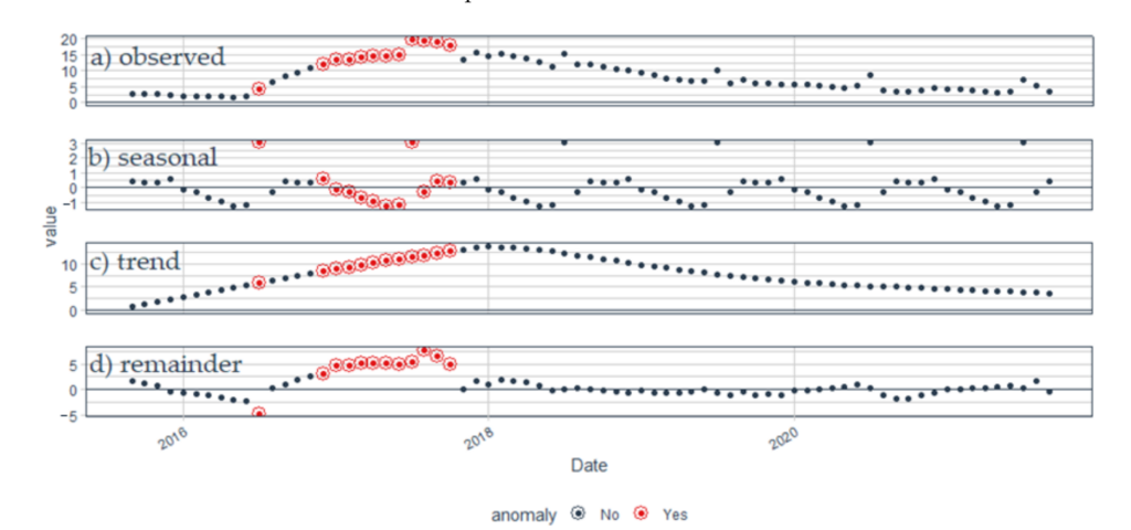
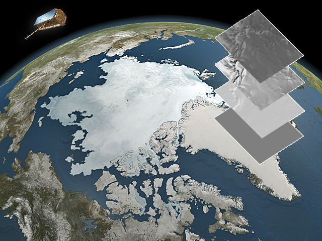
Research on surge-type glaciers, although they constitute a small percentage of all glaciers, significantly contributes to understanding glacier flow mechanisms. Recent studies have utilized remote sensing techniques to unravel these processes, highlighting the potential of combining high-performance computing and earth observation. While modeling surge events has gained popularity, there is a lack of comprehensive spatial and temporal data on surge timing. To address this, an algorithm has been developed that not only detects surge-type glaciers but also determines the onset of surges. The algorithm relies on time series analysis of glacier surface velocity using Sentinel-1 data, involving seasonal and trend decomposition and outlier detection via the General Studentized Extreme Deviate Test. Cluster analysis is then applied to identify outlier clusters associated with glacier surges. The method’s effectiveness was demonstrated in the Svalbard archipelago between 2015 and 2021, where 18 glacier surges and their timing were successfully identified.
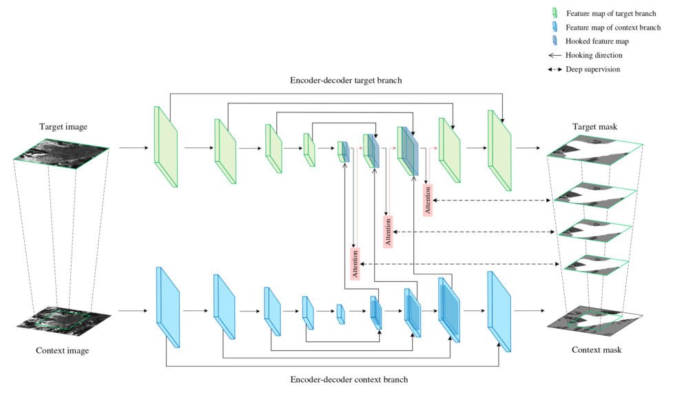
This article discusses the importance of tracking changes in glacier calving front positions as a means of assessing glacier status. Remote sensing imagery is a valuable tool for this purpose, but manual monitoring for all global calving glaciers is impractical due to time constraints. The article introduces a novel framework called AMD-HookNet, designed for the segmentation of glacier calving fronts in synthetic aperture radar (SAR) images. AMD-HookNet enhances feature representation by leveraging an attention mechanism and interactions between low-resolution and high-resolution inputs. The experiments conducted on a benchmark dataset demonstrate that AMD-HookNet outperforms the current state of the art by achieving a mean distance error of 438 meters to the ground truth, confirming its effectiveness.
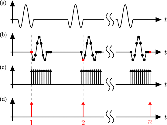
The concept of the sequential sampling is well known and still widely used in industrial automation radar applications due to its hardware simplicity, low cost and low power consumption. However, there is only a limited amount of publications that describe this concept and its variants in detail. This tutorial introduces the typical sequential sampling impulse radar concept step by step and presents several key characteristics, such as correlation properties and SNR considerations. In addition to the system theory, selected applications are presented to illustrate the attractiveness and elegance, but also the limits of this radar concept. The shown applications range from those in industrial automation to radar concepts in the areas of automotive radar, security scanners, biomedical radar systems and ground penetrating radar. The latter application is among others including the analysis of glaciers, e.g. to determine the ice thickness and stratification in order to provide a better understanding of the glacier and its behavior in a changing climate.
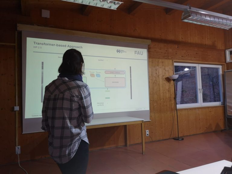
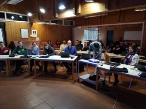
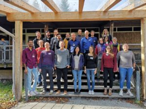
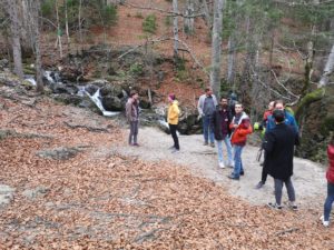
Right to the beginning of the IDP M3OCCA, we organized a “kick-off” workshop at FAU Erlangen in June 2022.
The workshop was the first gathering of all IDP M3OCCA Ph.D. students, including affiliated Ph.D. students. Many subproject supervisors were also around, so the workshop provided the fundament for a fruitful exchange and collaboration between all different institutions involved in the IDP M3OCCA.
Targetting snow drift and refreezing in glacier mass budgets with machine learning
Glacier surface mass balance (SMB) modelling has traditionally focused on improving the determination of surface energy balance conditions. However, water routing in the firn including refreezing, as well as the complex patterns of surface accumulation caused by snow drift, are poorly, or not at all, represented in most SMB models. Studies in the literature have often noted the uncertainties due to neglecting such mechanisms. This sub-project aims to improve the model representation of (i) the internal water budget and (ii) the snow drift contribution to the SMB using deep learning.
This aim links ideally with ongoing snowdrift measurements on Hintereisferner in the frame of a running joint project between FAU and the University of Innsbruck (http://schism-project.info/). It furthermore links very well with our strong background in SMB modelling and developing process-based model parameterizations. We hypothesize, however, that the accuracy of such parameterizations can be increased drastically by including machine learning algorithms and new measurements on snow drift dynamics.
In this subproject, we will explore the associated added value by sensitivity simulations and analyses of the resultant mass and energy balance components. An improved knowledge of the mechanisms in question is also important for the precise estimation of sea level contributions from glaciers measured from altimetry and DEM differencing (SP2.2 and 2.3), since the measured elevation changes have to be converted to mass using a certain density assumption. The SP also links to SP1.2 and SP1.3 where internal structures of the snow and firn cover are mapped.
For specific information on the sub-project please contact: Prof. Dr. Thomas Mölg, Institut für Geographie, Wetterkreuz 15, 91058 Erlangen, T: 09131-85-22633, thomas.moelg@fau.de, https://www.geographie.nat.fau.de/
Co-PIs: L. Nicholson, R. Prinz (Univ. Innsbruck), R. Hock (Univ. Oslo)
Want to learn more about Manuel’s research? Click here to access a short video! (the webcam video is from www.foto-webcam.eu)
My name is Manuel Saigger and within the IDP MOCCA I will be working on the influence of snow drift and internal refreezing on the glacier mass balance. Before I started working in Erlangen, I studied atmospheric sciences at the University Innsbruck. There I mainly focused on weather forecasting and weather simulations in alpine terrain and got really fascinated by the complex nature of flow fields in the surrounding of mountains. These complex wind patterns can in return lead to very complex patterns in snow accumulation, for example by redistribution of the snow.
Here my project comes into play. Because despite possibly being very important, this redistribution is not reflected in most glacier mass balance models, which on the one hand creates uncertainty in these models, but on the other hand gives us the opportunity to work on this problem and learn more about these fascinating processes.
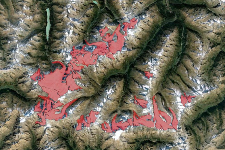
Glacier outlines from optical and SAR imagery by deep learning
Glacier extent is an ECV and various international attempts exist to harmonize a global glacier inventory data set with outlines if possible from multiple data sources (GLIMS, IASC Randolph Glacier Inventory, RGI).
However, to date no real operational large-scale repeat mapping capabilities exist. Glacier outlines are required at different time intervals e.g. with matching observational intervals for specific mass balance computations out of remote sensing measurements (e.g. for comparison with in-situ observations or on regional scale) or to validate ice dynamic modelling. In particular for small fast changing glaciers area updates are important since errors from area mismatch are highest.
While for calving glaciers various deep learning approaches exist outlines of land-terminating glaciers are often more difficult to delineate, in particular when the glacier tongue is debris-covered. We aim at an approach that integrates the advantages of synthetic aperture radar and optical observation capabilities and analysis techniques. The candidate is supposed to advance our existing processing setup and to develop and systematically test a new method. Within this doctoral project we aim at training a machine learning algorithm using multi-temporal SAR coherence images jointly with other data. This SP has strong thematic links to SP3.2 and 3.3 and methodological to SP 2.2.
For specific information on the sub-project please contact: Prof. Dr. Matthias Braun, Institut für Geographie, FAU, Wetterkreuz 15, 91058 Erlangen, T: +49 9131-85-22015, matthias.h.braun@fau.de, https://www.geographie.nat.fau.de/
Co-PIs: E. Bänsch (FAU Mathematics), P. Rizzoli (DLR HR), M. Zemp (Univ. ZH)
Originally coming from Michigan in the United States, I received my bachelor’s degree in Mechanical Engineering from the University of Michigan in April 2017. After subsequently working in the aviation field for a year, I moved to Munich to pursue my master’s degree in Earth Oriented Space Science and Technology at the Technical University of Munich. This program explored the uses of remote sensing, the technology behind it, and the geophysical processes to be observed. Through this, my desire to pursue research in the cryosphere was inspired and I started research in the Institute of Geography at the Friedrich-Alexander-Universität Erlangen-Nürnberg in May 2021.
This research focused on using deep learning techniques to detect supraglacial lakes in Northeast Greenland using Sentinel-2 data. Having been accepted to the IDP M3OCCA program, I am excited to now pursue my doctoral degree with the focus on the improvement of glacier outline segmentation using various remote sensing data while using the strengths of artificial intelligence.
Reconciling machine learning and glacier system modelling
Within this sub-project, we envisage to combine model-driven simulations of a coupled glacier system with data-driven machine learning techniques at specific benchmark sites in the Alps (e.g., Hintereisferner, Vernagtferner). A well-established ice-flow model will first be employed to produce observation-informed training and test data, which will then inform machine learning components that can replace such classical methods. The ultimate goal is to reduces computational efforts and prepare such hybrid techniques for long timescales and/or regional scales.
Detailed Information and position requirements of this SP are formulated in this PDF.
For specific information on the sub-project please contact: Dr. Johannes Fürst (NGL)
Department of Geography and Geosciences, Institute of Geography
Wetterkreuz 15, 91058 Erlangen, T: 09131-85-26680, Johannes.fuerst@fau.de Prof. Dr. Harald Köstler
Department of Computer Sciences, System Simulation
Cauerstraße 11, 91058 Erlangen, T: 09131-85-29359, harald.koestler@fau.de
Co-PIs: I. Tabone (FAU Geography)
O. Galiardini (Univ. Grenoble)
F. Maussion (Univ. Innsbruck)
Get to know our project affiliated PhD students
Mamta KC
mamta.kc@fau.de
Want to learn more about Mamta’s research? Click here to access a short video!
After graduating with a master’s degree in Environmental and Natural Resources from Kathmandu University, Nepal, I opted for the second master’s program in Climate and Environmental Science at the FAU Institute of Geography to broaden my horizon and enhance my environmental data analysis knowledge. During my master’s program, my interest in glacier environment, climatology, and machine learning grew.
The potential of deep learning applications to understand real-world physical phenomena captured my attention. Using efficient deep learning-based models to learn physics-based glacier models is a promising field of research. Thus, I look forward to incorporating machine learning into glacier modeling during my Ph.D. in the IDP M3OCCA program. My research will focus on developing physics-based deep learning emulators that will learn to predict the glacier dynamics. The emulators will be trained using the simulated data generated from the different glacier-based physical models.
Mass movement assessment and modelling in recent ice-free areas
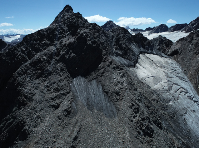
The retreat of glacier ice fundamentally changes stability of the surrounding rock and debris slopes due to the massive thermal, mechanical and hydrological change initiating massive creep and rock slope failures (Haeberli et al., 2010). Alpine and arctic polythermal glaciers develop permafrost below the upper cold-based glaciers and unfrozen rock below the warm based lower glacier parts. Glacier retreat and warming cause high rates of permafrost degradation and sometimes aggradation, sudden changes in hydro- and cryostatic pressures and fast changes in lateral ice-stresses on slopes (Krautblatter & Leith, 2015).
In SP3.3, we will develop generic mechanical models that undergo rapid thermal, mechanical and hydrological change. Release of ice stress and thermal conditions will be refined by additional information on glacier retreat (SP2.1) and on simulated basal ice temperatures (SP3.2). For the latter temperatures, SP3.3 will build on the finite-element Elmer/Ice applications calibrated to the benchmark glaciers for the last decades (SP3.2). Here, these simulations will be extended to cover the last century.
The presumable starting date is the end of the Little Ice Age (LIA). The modelling strategy is an initial equilibration run under LIA conditions followed by a forward simulation to present day forced by climatic data (e.g. ERA-20C, ERA5, CORDEX-CORE) downscaled to local AWS measurements (joint effort with SP3.1). The centennial scope assures that the long-term memory is imprinted in the 3D temperature field. Accounting for both retreat and temperature information, we will develop generic rock-ice-mechanical models using the benchmark sites Vernagtferner and Hintereisferner. The benchmark model will apply temperature-dependent changes in rock stability, ice stability in fractures and rock-ice interfaces as well as changes in hydro- and cryostatic forcing and lateral destabilisation due to reducing glacier support (Krautblatter et al. 2013). Model development will occur on basis of discontinuum mechanical (UDEC) models that have been developed in recent research projects (Mamot et al., 2020). The generic mechanical models will be clustered to specific conditions indicated by glacier retreat and elevation change information outside glaciers to constrain models that anticipate the propensity of major hazards due to rock slope and debris slope failures in the recently ice-free slope and glacier forefields.
For specific information on the sub-project please contact: Prof. Dr. Michael Krautblatter, Ingenieurfakultät Bau, Geo & Umwelt, Arcisstr. 21, 80333 Munich, T: 089-289-25866, m.krautblatter@tum.de, http://www.landslides.geo.tum.de
Co-PIs: J. Fürst (FAU Geography), B. Etzelmüller, S. Westermann (Univ. Oslo)
Want to learn more about Felix’ research? Click here to access a short video!
I am Felix. My research focuses on understanding the interaction between glaciers and permafrost in alpine environments. During paraglacial transition phases, as the landscape changes from ice to ice-free states, geomorphic activity is higher than usual. The relatively rapid and drastic change in thermal and hydrological characteristics predisposes rock slopes to a more fragile state. Furthermore, the evolution of permafrost in space is critical for the assessment of rock slope stability and potential hazards.
My aim is to develop a rock-ice mechanical model suitable to predict rock mass failure concomitant with changing cryospheric conditions. Besides rock mechanical laboratory experiments I will take advantage of the capabilities of the MOCCA group by having a joint field campaign using geophysics to explore glacial and permafrost conditions at a study site in Kaunertal. The knowledge of seismic, geoelectric and radar measurements will complement the permanent temperature monitoring of rock surface temperature to gain insights into the thermal characteristics at the study site. By coupling the mechanical model to a dynamic thermal model, we will be able to assess and predict rock mass failures in time.
Besides scientific goals you can hang out with me to blues rock music, even better to play some music together, to do some rock climbing or go fishing. As growing up in the Alps I am happy to work on a local study site in my home region.
Radar penetration of TanDEM-X on glaciers & ice caps SAR tomography for 3D imaging of snow and firn structures
The radar signal can penetrate into snow, firn, and ice bodies depending on liquid water content and internal structure of the porous medium as well as radar imaging parameters. Consequently, the interferometric phase center of the backscattered radar signal is located at a certain depth below the actual topographic surface, leading to a bias between the glacier surface and the estimated one from SAR interferometry (Rott et al 2021, Rizzoli et al 2017). Radar penetration is still a large source of uncertainty in estimates of glacier volume and mass change from bi-static SAR mission data like bi-static TanDEM-X or the upcoming HRWS MirrorSAR (Braun et al. 2019, Huber et al. 2020).
The uncertainty is highest in presence of dry snow, not affected by melting phenomena as in the accumulation area of high mountain glaciers or polar glaciers and ice caps outside the large ice sheets. Within this sub-project, we aim at estimating radar penetration by deploying a deep learning architecture using input data from SAR imagery like coherence, backscatter, frequency and geometric baseline as well as a terrain model. As reference data for training deep learning networks in a supervised manner, we will utilize the height difference between precise laser altimetric measurements (ICESat-2, Operation IceBridge, ka-band data from JPL UAVSAR system) for the surface and radar DEMs for the location of the mean interferometric phase center.
Methodologically, we suggest the use of a deep convolutional network to estimate the altimetry, phrasing it as a regression problem. In particular, we propose the adoption of AdaIn-based Tunable CycleGAN (Gu 2020). We believe the additional CycleGAN constraints in combination with the switchable adaptive instance normalization will serve as a valuable regularizer. Making the CycleGAN tunable and hence, omitting one generator from the original CycleGAN approach, leads to a significant reduction in memory requirements and a more stable training process even on small datasets. Additionally, we can incorporate other data such as the local incident angle as well as climatological information as conditional input for the discriminators, since both variables can significantly influence the interferometric SAR phase center depth below the actual surface. This SP is linked to SP 1.2 with a joint airborne survey as well as to SP 2.3 and SP 3.1.
For specific information on the sub-project please contact: Dr.-Ing. Paola Rizzoli, Münchener Straße 20, 82234 Weßling, T: 08153-28-1785, Paola.Rizzoli@dlr.de, https://www.dlr.de/hr/desktopdefault.aspx/tabid-2328/3447_read-46107
Co-PIs: M. Braun (FAU Geography), A. Maier (FAU Informatics), P. Millilo (Univ. Houston)
I am a Ph.D. student both at the German Aerospace Center (DLR) and the Friedrich-Alexander-Universität Erlangen-Nürnberg (FAU), being supervised by Prof. Matthias Braun (FAU) and Dr. Paola Rizzoli (DLR).
I have a bachelor’s in Electrical Engineering and a master’s in Telecommunications, both from universities in Brazil (where I came from!). The goal of my research was to develop methods for target detection and pattern recognition in synthetic aperture radar (SAR) images, mainly in military applications. After I received my master’s degree (March/2021) and seeking to work in a field in which I could see my work impacting people’s lives, I worked as a data scientist for a startup in Brazil, tackling problems in the agribusiness market. The company was heavily driven by how to improve the sustainability of medium- and large-sized companies and farmers in agriculture, which was a great learning experience and provided a lot of personal growth.
In this scenario, I heard about the IDP M³OCCA project and its ambition to be an interdisciplinary and international environment aiming at understanding and solving problems that can truly impact society. I am glad to be part of the project and thrilled to continue my research career in such a place.
Glacier mass balance variations are an essential indicator of regional and global climate fluctuations. Today, glacier volume changes can be detected with satellite based systems to a reasonable degree of accuracy, while density estimates of the affected volume are still based on models and a priori assumptions. Even though, methods for volume to mass conversion are established, there exists a considerable knowledge gap with respect to the validation and temporal stability of the assumptions. Especially the transient evolution of the firn pack will strongly influence the density assumptions of the glaciers with time. During periods of negative mass balances, the shrinkage of the snow and firn resources requires an adaptation of the usual conversion techniques. In addition, there is a strong need to investigate the regional variability of density distribution, as the glacier-climate relation is strongly dependent on the regional characteristics like topography, precipitation and wind patterns.
A large data basis exists for Vernagtferner in the Ötztal, related to the temporal development of the glacier and its firn regions. Similar information is available for the adjacent Hintereisferner, making this region an ideal test site for such investigations. A detailed investigation of firn and snow deposits, based on glaciological and geophysical methods and microwave remote sensing instruments should be conducted to provide a clear knowledge about the firn pack architecture and its spatial distribution. In combination with legacy remote sensing observations of firn and snow extents and volume changes, regional climate information will be used to investigate the temporal development of glaciers and their compartments. This analysis should lead to a strongly improved approach for volume to mass conversion, especially with regard to temporal and regional variability, which is also essential for large-scale mass balance assessments. Direct employment of the results in, and exchange with the modelling-orientated sub-projects will be possible and highly welcome.
For specific information on the sub-project please contact: Dr. Christoph Mayer, Alfons-Goppel-Str. 11 (Residenz), 80533 München, T: 089-23031-1260, Christoph.Mayer@badw.de, https://geo.badw.de/das-projekt.html
Co-PIs: T. Mölg (FAU Geography), M Huss (ETH ZH), R. Hock (Univ. Oslo)
Want to learn more about Akash’s research? Click here to access a short video!
I am a PhD student working at BAdW Munich in collaboration with FAU Erlangen. My working research project is mainly on the density profiling of the snow to ice on the Alpine glaciers. My fascination with researching glaciers has come from my time during my master’s in Applied & Environmental Geoscience (AEG) at the University of Tuebingen Germany. Where I have attained enough knowledge on the application of GPR to subsurface hydrogeology as my Master’s thesis under the supervision of Prof. Dr Reinhard Drews. My push towards nature science can be attributed to my bachelor’s studies in Civil engineering and my working experience in the construction industry and with the NGO as an Environmental and Civil engineer.
In my PhD, research is on the quantitative study of the variation of density with the depth from Snow to Ice in the Alpine Glaciers mainly on the Vernagtferner glacier. Application of GPR to attain spatial and temporal data at the accumulation zone during different seasons of the year, to track the boundary between firn and ice and to understand the dynamics of the glaciers with the regional climate change. This work is supervised by Dr Christoph Mayer at BAdW Munich and Prof. Dr Thomas Mölg from FAU Erlangen.
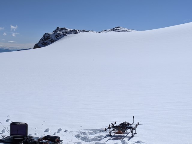
A lightweight multifrequency radar system for snow and frin structure measurements
Typically ground-based GPR systems for geophysical applications consist of low frequency pulse radars that operate in the MHz frequency range. As those rudimentary radar concepts have proven to be easy to use and offer enough resilience to endure in rough environments in the past, the most recent and enormous advances in radar technology have almost exclusively been made in other fields such as automotive radar or personnel security scanner systems. Innovative GPR approaches can strongly benefit from these new radar techniques e.g. by multi-functional radar systems that utilize software-defined waveforms and measuring principles best adapted to the specific environment and measuring task.
A holistic hardware-software design based on cutting-edge technology is needed to obtain the maximum performance for the intended field of use. By this, enhanced mapping and surveying of subglacial structures will be achieved, and previously unsolved challenges linked to the measurement of ice and snow parameters in remote locations will be effectively addressed. A lightweight and easy-to-transport radar system will be developed within this project which will serve as a versatile sensor setup for multiple applications in remote glacial environments. For this, a multifrequency system will be implemented which will make use of the benefits of different frequency bands. E.g., typical GPR systems for measuring ice sheet thicknesses on alpine glaciers operate in the sub 200-MHz region as signals experience less attenuation but can only obtain comparably small bandwidths and therefore low resolution. Imaging Radars working in the >1GHz frequency range suffer from higher attenuation but can reach an outstanding resolution. Those and further advantages will be combined for maximum performance and flexibility adapted to each scenario.
For this purpose, suitable high-performance and meanwhile power and weight-saving transceiver frontend concepts need to be designed and tested for their usability. Furthermore, innovative antenna concepts need to be examined in order to address the requirements of lightweight and small size while maintaining excellent radiation characteristics over a wide/multiband frequency range. With the integration of localization techniques such as differential GNSS and other advanced self-localization techniques, it will be possible to apply ground-based SAR techniques for enhanced resolution and sensitivity of the overall system. The integrated digital backend will exploit cutting-edge radar algorithms which have to be expanded in order to combine data taken in different frequency bands for extracting an even wider range of parameters from the surveyed ice structures compared to a single band evaluation.
Examples for those results are amongst other things estimated water content in the snow/firn cover or the glaciers permittivity profile which is directly linked to the ice density. Integrated into vehicles such as UAVs the system will be capable of surface-based mapping of large areas in a time and cost-effective manner. The system will be tested extensively on Vernagt- and Hintereisferner. This subproject will collaborate with SP1.2, 1.3, 2.3 and 3.1.
For specific information on the subproject please contact: Prof. Dr.-Ing. Martin Vossiek; Institute of Microwaves and Photonics (LHFT), Cauerstr. 9, 91058 Erlangen, T: 09131-85-20773, martin.vossiek@fau.de, https://www.lhft.eei.fau.de/
Co-PIs: G. Krieger (DLR HR), T. Seehaus (FAU Geography), F. Navarro (U. Madrid)
Get to know our project affiliated PhD students
Danielle Gunders-Hunt
danielle.gunders-hunt@fau.de
I completed my master’s degree in Electrical and Electronic Engineering at the University of Western Australia, where I developed a strong interest in high-frequency technologies. Combined with my passion for nature and the environment, the application of radar technology to analyze glacial ice and snow structures is especially exciting, given the ongoing challenges posed by climate change and environmental degradation.
My PhD research within the scope of the IDP M3OCCA focuses on a high performance, flexible and easily transportable radar system to gain detailed insights into glacial structures and their variations over time.
SAR tomography for 3D imaging of snow and firn structures
Structures in the firn and snow cover on glaciers can be caused by annual melt/freeze cycles, but also by internal water percolation or refreezing. Additionally, water channels within the glaciers are important indicators for melt water routing in geophysical and hydrological glacier models. The highest changes occur within the upper layer (first tens of meters) and are therefore of importance to be monitored. Synthetic Aperture Radar (SAR) tomography is an evolving 3D imaging technique that enables the mapping of subsurface properties of glaciers and ice sheets with high spatial resolution, taking advantage ofthe penetration of radar signals up to several tens of meters into dry snow, firn, and ice (Tebaldini et al., 2016, Fischer et al., 2019). The main objective of this doctoral project is to exploit and improve this powerful 3D imaging technique and to establish the relation of the vertical reflectivities to geophysical snow/ice parameters. Moreover, new tomographic imaging modes and techniques like transmission, MIMO and subaperture-based tomography will be explored in view of their potential to gain further information about the internal structure and dielectric properties of snow and glaciers. In the frame of the project dedicated campaigns on Vernagtferner and Hintereisferner will be conducted, where multiple sensors collect data to estimate and characterise the internal structures of snow and ice regions. For this, the airborne multi-modal SAR system of DLR, as well as ground-based laser and radar systems will be deployed to acquire both multi-angular and multi-temporal data. Simultaneously, point/grid-based measurements and satellite data will be collected and evaluated. Strong links exist to SP1.1, SP1.3, SP2.2, SP2.3 and SP3.1.
For specific information on the sub-project please contact: Prof. Dr.-Ing. Gehard Krieger, LHFT, Institute of Microwaves and Photonics (LHFT), Cauerstr. 9, 91058 Erlangen, T: 08153-28-3054, gerhard.krieger@fau.de
Co-PIs: I. Hajnsek (DLR HR / ETH ZH), C. Mayer (BAdW), H. Rott (ENVEO IT)
Get to know our project affiliated PhD students
Patricia Schlenk
Patricia.Schlenk@dlr.de
I am a PhD student both at the German Aerospace Center (DLR) and the Friedrich-Alexander-Universität Erlangen-Nürnberg (FAU), being supervised by Prof. Gerhard Krieger (FAU/DLR) and Prof. Irena Hajnsek (DLR).
I studied environmental engineering at the Technical University of Munich. Furthermore, I specialized in hydraulic engineering and water management as well as hydrology. The goal of my master thesis was to build, to adapt and to automate an existing Wet Snow Mapping Algorithm by Thomas Nagler in order to get detailed information about snow as well as glacier melt. This thesis really peaked my interest in SAR and snow/ glacier research and I believe to provide a contribution to the further development in this field of study.
In addition to my academic interests, I have always been interested in other cultures and foreign countries. I went to high school in the U.S. and New Zealand for a total of eight months, studied French for a year at the Université inter-âges in Paris, and spent a semester at the École polytechnique fédérale de Lausanne. I was able to put the experience and knowledge I gained during my time abroad to good use as a student representative and in my work at the TUM Center for Study and Teaching for five years. There I advised mostly international students on problems within their studies. The IDP M³OCCA with its interdisciplinary and international approach is an excellent continuation of my previous work.
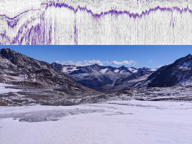
Information on ice thickness and internal structures of ice bodies (e.g. water table, isochrones, water pockets, and channels) from ground penetrating radargrams is to date often picked manually. Often only a specific target neglecting all other information is traced since existing contour-following algorithms in standard software like REFLEX do not provide consistent and reliable output. Within this doctoral project, we aim at using and modifying machine learning techniques from medical imaging as well as natural language processing (NLP) and apply those to glaciological radargrams. Ice thickness, bedrock topography, as well as internal structures, shall be mapped ideally at once after the respective pre-processing of the radargrams has occurred. Each radargram is composed of lines denoting different structures in the ice body. Algorithmically, this represents a segmentation problem in radargrams. Datasets are available from airborne and ground-based low-frequency radar surveys of sites in the Alps and high Mountain Asia (BAdW), planned campaigns in Patagonia and alpine-type glaciers in Antarctica (FAU). Additional material for algorithm testing and training is available through an intense collaboration with AWI from polar surveys. Ideally, the developed algorithms will also be tested on the first survey data of the developed new multi-frequent radar in sub-project 1.1. Further links exist also to SP 2.3, and 3.1.
Co-PIs: A. Maier (FAU Informatics), T. Seehaus (FAU Geography), F. Navarro (U. Madrid)
Get to know our project affiliated PhD students
Marcel Dreier
marcel.dreier@fau.de
Want to learn more about Marcel’s research? Click here to access a short video!
Hi, I am Marcel, and I studied Computer Science at Friedrich-Alexander-Universität Erlangen Nürnberg. I finished my master’s degree in August 2023, and I am currently a PhD student at the Pattern Recognition Lab at Friedrich-Alexander-Universität Erlangen Nürnberg under the supervision of Prof. Andreas Maier.
My research in the M3OCCA project focuses on the segmentation of glacier radar images using deep learning. Since glacier radar images are usually segmented by hand, geographers spend many hours dividing the glacier into different sections. Especially with the increase in data in recent years, this task has become very expensive. Hence, my research aims to alleviate that problem by using deep learning to speed up and automate the segmentation of glacier radargrams.
In my free time, I enjoy going for walks and bouldering.