Latest Posts

Event Outreach

Young Scientist Award and Karl-Jörg Langenberg Award for Alexandre Becker Campos

With great pleasure we announce that Alexandre Becker Campos received two awards, the Young Scientist Award and Karl-Jörg Langenberg Award (Best Paper Award, second place) at the Kleinheubacher Tagung 2025 with his work entitled “A Snow Properties-Aware Deep Learning Framework for Large-Scale Estimation of Penetration Bias in TanDEM-X DEMs.”

This work demonstrates that the proposed physics-aware, AI-based approach can compensate biases in TanDEM-X digital elevation models (DEMs) with centimeter-level accuracy over ice sheets and can support glaciological applications such as snow depth estimation and mass balance of glaciers.

We congratulate Alexandre on his outstanding work and on these special awards!

Publications

A Kalman filter-based framework for assimilating remote sensing observations into a surface mass balance model

This study introduces a custom implementation of the Ensemble Kalman Filter (EnKF) for calibrating a three-dimensional glacier evolution model. The EnKF can assimilate observations as they become available and provides uncertainty measures for the initial state after calibration. We calibrate an elevation-dependent surface mass balance (SMB) model using elevation change observations and test the EnKF’s performance in a Twin Experiment by varying internal and external hyperparameters. The best-performing configuration is applied to the Rhône Glacier in a Real-World Experiment. Using satellite-based elevation change fields for calibration, the EnKF estimates an average equilibrium line altitude of 2920 ± 37 m for the period 2000–2019. A comparison of the results with glaciological measurements demonstrates the capabilities of the EnKF to simultaneously calibrate multiple SMB parameters. With this proof of concept, we expect that our methodology is readily extendable to other map or point observations and their combination, as well as to other calibration parameters.

Publication available on:https://doi.org/10.1017/aog.2025.10020

Allgemein Outreach

Nora Gourmelon’s research on AI technology for glacier changes featured in FOCUS article

Nora Gourmelon, a PhD student at the Pattern Recognition Lab and part of M3OCCA, was recently featured by FOCUS in an article highlighting her research on monitoring glacier retreat with artificial intelligence. The feature, titled “Deutsche Forscherin entwickelt Technologie, die das Sterben der Gletscher offenbart”, presents her work on developing AI-based methods to automatically analyze radar satellite imagery and reveal changes in Arctic glaciers.

Her research contributes to the broader effort of using “green AI” technologies to support climate science and environmental monitoring.

Read the full article here: focus.de

Outreach

Guest Talk at the Indian Institute of Science (IISc) Bengaluru, India 2025

In 2025, Akash Patil presented his research on “Investigating firn structure and density in the accumulation area of Aletsch Glacier using Ground Penetrating Radar” in the monthly seminar series organized by Dr. Brahma Dutt Vishwakarma at the Interdisciplinary Centre for Water Research (ICWaR), Indian Institute of Science, Bengaluru. The seminar brought together PhD students and postdoctoral researchers from a wide range of disciplines, including gravimetry for groundwater monitoring, glacier lake outburst floods (GLOFs), and remote sensing and geophysical approaches to glacier mass balance. This was a great opportunity to share Akash’s work, exchange ideas across fields, and build possible collaborations aimed at advancing our understanding of Himalayan glaciers, which are increasingly affected by glacierrelated flood events in recent years.

Event

Annual retreat of the doctorate programme M3OCCA in Erlangen

This year’s annual research retreat of the M3OCCA international doctorate programme (IDP) took place in Erlangen. It was the last official research retreat within the first phase of the IDP. The doctoral students presented the current status of their research projects, and it was a pleasure to see the progress made over the last few years, as many of the doctoral students are nearing the completion of their projects. In addition, preparations for the second phase of the IDP were initiated and the next steps discussed.

Of course, we also took time for some social activities, including a scavenger hunt through the city of Erlangen and a quiz night.

Event

Participation in the HEFEX III campaign

Self-built fixed-wing UAV with a sonic anemometer (black device) and temperature & humidity sensors (inside beige pipe).

To investigate the boundary layer between glaciers and the atmosphere, the third Hintereisferner Experiment (HEFEX III) was conducted in August on glacier Hintereisferner in Austria. The campaign was organised within the frame of the Glacier Space Project from Humboldt-University Berlin (HUB) and University of Innsbruck (UIBK), with the main goal to measure vertical profiles of temperature, humidity, wind direction and speed synchronously along the glacier flow line. Along with participants from HUB, UIBK, University of Graz, University of Western Norway and University of Augsburg, the Team of the DFG-project ‘FlyHigh’ from FAU Erlangen-Nürnberg (picture above) was taking part with their fixed-wing UAVs (picture left side), equipped with a sonic anemometer for  wind direction/speed, and another sensor for temperature and humidity measurements. To bridge the gap between the glacier and synoptic wind , the fixed-wings measured between 25 – 500 m above ground level.


DJI Mavic Pro carrying temperature & humidity sensors.

To ensure a  continuous profile, a DJI Mavic Pro quadcopter (picture left side) equipped with temperatur and humidity sensors sounded the boundary layer between 0 – 120 m agl. Over the course of three days, this profile was measured every three hours. In the lower part of the glacier, a 10 m high tower was set up, with several instruments for continuous windspeed/direction, turbulence, gas temperature, and humidity measurements at different levels. In a preview of the results (below), you can see the processed air temperature and relative humidity from one afternoon flight.

Preliminary processed air temperature and relative humidity profile on 08.08.2025 at 2 p.m. from the fixed-wing UAV.

Of course the social life should not be neglected when camping on a glacier, so we met up with most of the other teams at the Hintereisferner hut in the evening to enjoy a three course dinner, prepped on only two gas hotplates. On Sunday we walked to our cars, trying to carry down as much equipment and material as possible.
In the end a very exciting data set was obtained, which, after processing and analysis, should provide valuable insights into boundary layer processes over a melting alpine glacier.

Allgemein Outreach

Global Media Spotlight on M³OCCA Research: Perito Moreno Glacier Study Gains International Attention

The IDP M³OCCA is proud to announce the remarkable international reception of the study “The State and Fate of Glaciar Perito Moreno, Patagonia”, recently published in Nature Communications Earth & Environment (link).

The study led by Moritz Koch, affiliated doctoral candidate of the M³OCCA program, in close collaboration between FAU’s Institute of Geography and the German Aerospace Center (DLR), sheds new light on the dynamics and future of one of the world’s most iconic glaciers. This work exemplifies the strong interdisciplinary collaboration and scientific excellence fostered within M³OCCA.


International Media Coverage

The groundbreaking results have resonated widely beyond the academic community. Major international outlets have reported on the study, including:

  • The New York Times: “A Famously Stable Glacier in Argentina Suddenly Looks Anything But” (read here)
  • ABC News: “Massive 18-Mile-Long Patagonia Glacier Experiencing Rapid Change” (read here)
  • Die Zeit (Germany): “Perito-Moreno-Gletscher in Argentinien zieht sich zurück” (read here)

Additionally, the research has been featured in leading radio outlets, including an in-depth interview for Deutschlandfunk’s “Forschung aktuell” (listen here, minute 10).


Research Impact

The study’s reach is also reflected in its exceptional Altmetric performance (last update 21.08.25):

  • Ranked 61st of 197,646 articles of similar age across all journals
  • Ranked 1st among all articles of similar age in Communications Earth & Environment

These metrics highlight the outstanding scientific and societal relevance of the work.


A Showcase of M³OCCA Collaboration

The success of this publication underscores the spirit of the M³OCCA program, where young researchers work hand in hand with leading institutions. Lead author Moritz Koch demonstrates the program’s commitment to producing research that resonates both within academia and with the public worldwide.

Allgemein Publications

The State and Fate of Glaciar Perito Moreno

The Perito Moreno Glacier, a 30 km long outlet of the Southern Patagonian Ice Field in Argentina, has been considered unusually stable among Patagonian glaciers, exhibiting almost no retreat between 2000 and 2019. In this paper we present our findings of an acceleration in ice loss since 2019, with retreat exceeding 800 m in some areas and a 16-fold increase in thinning rates at the terminus, from 0.34 m yr⁻¹ (2000–2019) to 5.5 m yr⁻¹ (2019–2024). Using helicopter-borne radar surveys in March 2022 and bathymetric mapping of the proglacial lake, integrated with satellite-derived surface height and velocity data, we identify a prominent subglacial ridge beneath the glacier terminus that likely sustained its prior stability. Current thinning trends suggest imminent detachment from this ridge, which would trigger rapid multi-kilometre retreat into a deep basin, promoting further mass loss via calving.

Publication available on: https://www.nature.com/articles/s43247-025-02515-7

Allgemein Publications

From Sea to Summit: Investigating the Explicit Role of SST Increase for Regional and High-Altitude Climates in New Zealand

The oceans around New Zealand are warming much faster than the global average, affecting the region’s climate. Mountain regions like the Southern Alps are particularly sensitive, as small shifts in temperature and precipitation strongly influence glaciers, ecosystems, and water supply. To isolate the role of ocean warming, this study uses an atmospheric model to simulate New Zealand’s climate for 2010–2020 under two sea surface temperature (SST) scenarios: observed warming and a cooler baseline (1981–2010 average). The comparison shows that warmer oceans made the atmosphere warmer and more humid, especially in autumn and summer. This most likely affected wind patterns and atmospheric moisture transport, leading to changes in precipitation across the South Island. In the high elevations of the Southern Alps, many effects are amplified, with stronger warming, reduced snowfall, and a greater dominance of rainfall.

Publication available on: https://doi.org/10.1029/2025JD043572

Allgemein Event

Summer expedition to Aletsch Glacier 2025

A trip to the glacier is an opportunity to bring the algorithms to life. From the 4th to the 19th of July 2025, Danielle Gunders-Hunt (FAU Erlangen-Nürnberg, M3OCCA) and Valentin Marx (FAU Erlangen-Nürnberg, M3OCCA affiliated) were situated at the Jungfraujoch research station in Switzerland to collect radar measurements using custom-built radar systems.

This summer’s fieldwork took us to the Aletsch Glacier in Switzerland. We drove to Grindelwald on Thursday and met up with colleagues from RWTH Aachen and the University of Wuppertal, affiliated with the TRIPLE project. After an impressive gondola ride and train journey through the mountain, we arrived at the research station located at 3,454 m a.s.l.

Our brave mountain guide jumping into a crevasse, expecting us to save him.

The research station is home only to researchers and is managed by a couple who oversee the High Altitude Research Stations Jungfraujoch & Gornergrat. They showcased the fascinating equipment held permanently on the glacier, ranging from instruments measuring air constituents for climate change monitoring, to medical and biological experiments observing the influence of high altitude on organisms.

The next day we began with a guided tour led by a mountain guide to learn the basic rescue techniques and familiarize ourselves with the glacier terrain. Unstable weather in the first few days caused some delays, but we soon began carrying out our full set of measurements with the GPR sled.

Our goal was to evaluate our equipment in various walking formations to assess the efficiency of each imaging method. Different formations can leverage different algorithms to generate 2D or 3D images of the snow and firn layers, as well as crevasses hidden beneath the surface.

Both radar systems used during the campaign were developed in-house at the Institute of Microwaves and Photonics (LHFT), FAU Erlangen-Nürnberg. The first system was an impulse radar operating at a center frequency of 1.35 GHz. Impulse radar transmits short, broadband pulses and listens for echoes reflected from internal glacier boundaries—such as transitions between snow, firn, ice—or from embedded features like crevasses, air pockets or water inclusions. We then replaced the radar system with a frequency-modulated continuous wave (FMCW) radar, ramping between 0.7 and 4.7 GHz. Unlike impulse radar, FMCW continuously emits a frequency-modulated signal and compares the transmitted and received waves to measure the time delay and amplitude of returning echoes. This method offers improved sensitivity and resolution, especially for fine structures near the surface.

Tracks we were walking to test out various reconstruction algorithms.
The sled being dragged in a measurement scenario.


We are now looking forward to analyzing how each type of radar—together with its frequency and signal power—affects both the penetration depth and the resolution of subsurface glacial features.

The fieldwork was a rewarding collaborative experience. Working alongside the TRIPLE team, who were testing a hybrid radar and sonar based forefield reconnaissance system integrated into a melting probe, reaching 12 m beneath the surface, gave us valuable insights into subsurface structures which we hope to cross-validate with our radar results.

Valentin improvising resourceful ways of preparing Spätzle.

Beyond the scientific goals, sharing meals, challenges, and ideas made the high-altitude days both productive and memorable. Each evening, breathtaking sunsets from the Sphinx Observatory (3,570 m a.s.l.) reminded us how extraordinary our setting truly was—it felt like we were on top of the world!

This campaign wouldn’t have been possible without the support of Valentin Marx, Lukas Rechenberg, and Niklas Haberberger, as well as the remaining colleagues from the TRIPLE-FRS-2 project.

The M3OCCA project is generously funded by the Elitenetzwerk Bayern.

Incredible sunsets from the Sphinx observatory.


Allgemein Event Outreach

IDP M3OCCA second phase is approved

The Bavarian State Ministry of Science and Arts has approved a second phase of the International Doctorate Program “Measuring and Modelling Mountain Glaciers and Ice caps in a Changing Climate” (IDP M³OCCA) as part of the Elite Network of Bavaria (ENB). In the second phase, we will continue the close collaboration between FAU, the Technical University of Munich, the Microwave Institute of the German Aerospace Center (DLR) in Oberpfaffenhofen, and the Bavarian Academy of Sciences (BAdW).

The aim of the IDP is to develop innovative methods and technologies to quantify global glacier retreat more accurately over large areas and reduce existing uncertainties. Artificial intelligence techniques are used, for example, to analyze large-scale satellite data or to improve physics-based process models. In addition, the researchers are further developing pioneering technologies such as radar tomography and geophysical models to enable improved forecasts.

Starting in June 2026, nine doctoral students will be funded for four years by the ENB. In addition, the new funding includes a postdoctoral position to help graduates of the current funding phase transition into independent scientific work. M³OCCA is characterized by a high degree of internationality and interdisciplinarity and trains its young scientists in a structured support program in addition to their professional qualifications. In addition to the doctoral students funded by the ENB, doctoral students from other funding programs—such as various junior research groups—are explicitly allowed and encouraged to participate in the IDP in order to create a broader scientific and thematic basis and facilitate lively exchange.

Allgemein Event

Winter expedition to Aletsch Glacier 2025

A much-awaited winter 2025 Aletsch expedition was carried out to attain repeat glaciological and geophysical measurements at locations similar to the winter 2024 Aletsch campaign. An expedition aimed to detect changes in firn stratigraphy and firn density over two consecutive years under the influence of regional climatic changes. This was achieved by using Ground Penetrating Radar (GPR) profiling across the two main accumulation zones of the Aletsch glacier. The GPR-based common mid-point (CMP) method was used to gather indirect firn density measurements. This was complemented by the deep firn core (nearly 20 m) at the upper part of the Ewigschneefeld, a shorter firn core (approximately 8 m) at the lower part of the Ewigschneefeld, and two snow pits at Jungfraufirn and the Ewigschneefeld.

This expedition is part of the M3OCCA international doctoral program (IDP) project SP2.3. The campaign was a collaborative effort of Paul Scherrer Institute (PSI), Bern, Switzerland, BAdW, Munich, and FAU Erlangen, Germany.

We appreciate the efforts of the firn core team, Dr. Theo Jenk, Michelle Worek (PhD), and Samuel Marending from Laboratory of Analytical Chemistry, PSI Bern, Switzerland, Dr. Christoph Mayer, Dr. Astrid Lambercht, and Akash Patil (PhD) from Department of Geodesy and Glaciology BAdW Munich, Germany, and Dr. Thorsten Seehaus and Dr. Alexander Groos from Institute of Geography FAU Erlangen, Germany.

Allgemein Publications

Climate’s firm grip on glacier ablation in the Cordillera Darwin Icefield, Tierra del Fuego

The Cordillera Darwin Icefield (CDI) in Tierra del Fuego is one of the largest temperate ice bodies in the Southern Hemisphere. In this study, we simulate the climatic energy and mass balance of its glaciers (2000–2023), which are sensitive indicators of climatic changes in the Southern Hemisphere’s higher mid-latitudes. Year-round westerly winds cause strong climatic gradients across the mountain range, reflected in the energy and mass fluxes. Our results reveal a significant increase in surface melt (+0.18 m w.e. yr-1 per decade) over the past two decades. We also present the first estimate of dynamically controlled mass loss into adjacent fjords and lakes by frontal ablation, amounting to 1.44 ± 0.94 Gt yr-1 (26 % of the total CDI mass loss). Frontal losses are mainly channelized through few marine-terminating glaciers. While frontal ablation is important for predicting the fate of individual glaciers, for the CDI as a whole, atmospheric conditions exert the main control on the current glacier evolution.

https://doi.org/10.1038/s41467-025-57698-6

Event

Winter Fieldwork Hintereisferner 2025

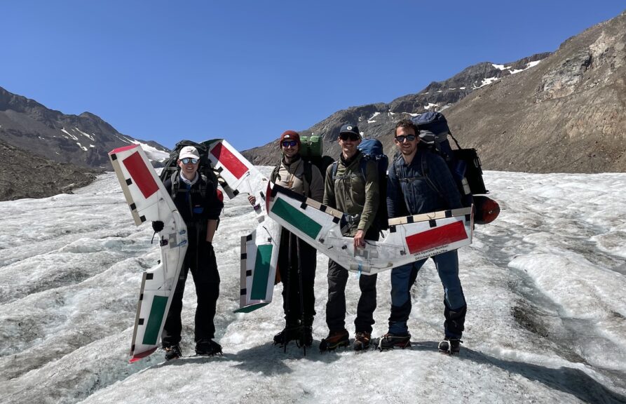
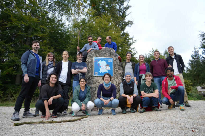
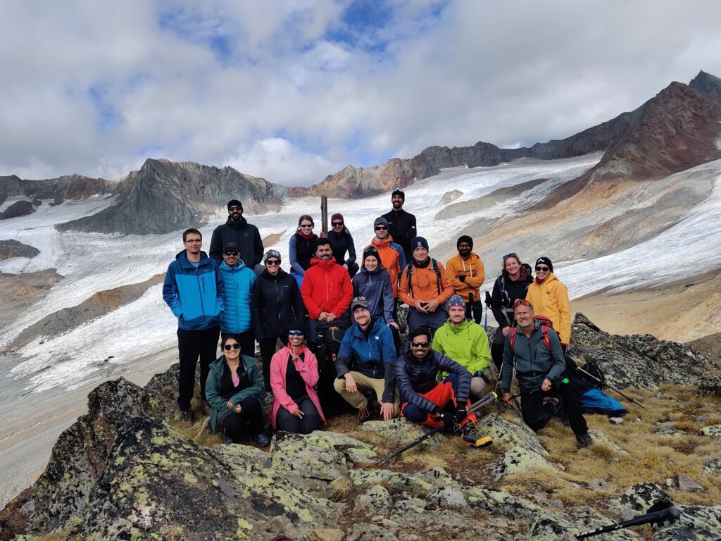
During regular office days, a glacier often feels very far away. Fieldwork is always exciting because it provides a clearer understanding of what we are actually researching. From April 1st until April 4th 2025, Céline Walker (FAU Erlangen-Nürnberg, M3OCCA-affiliated), Felix Pfluger (Technische Universität München (TUM), M3OCCA) and Léa Rodari (Université Lausanne (UNIL)) were in the field to acquire GPR data on Hintereisferner, Austria, for the M3OCCA-affiliated DeLIGHT Junior research project.

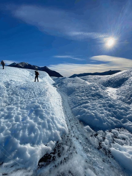
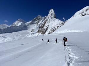
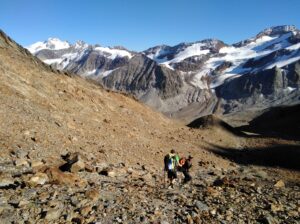
For this spring’s fieldwork, we went to the Hintereisferner in the Austrian Alps. We drove to Rofental on Tuesday and met up with colleagues from the Universität Innsbruck (UIBK). Together, we went to the small research station situated at 3,050 m a.s.l., which offers an excellent view of the impressive glacier. The hut was our home for the next three days and is equipped with a small gas stove, a table, eight beds, plenty of gumboots, a guitar, and an old portable gramophone.

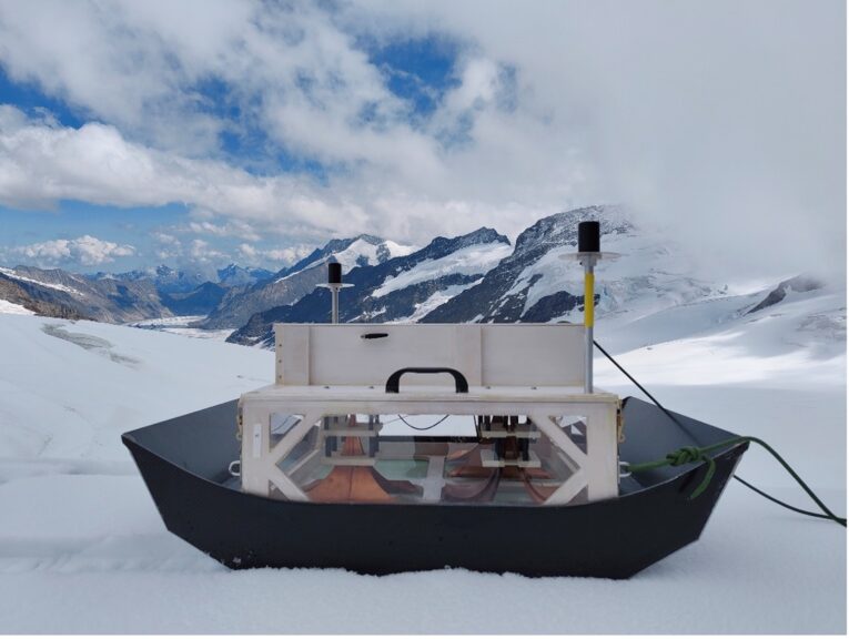
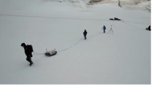
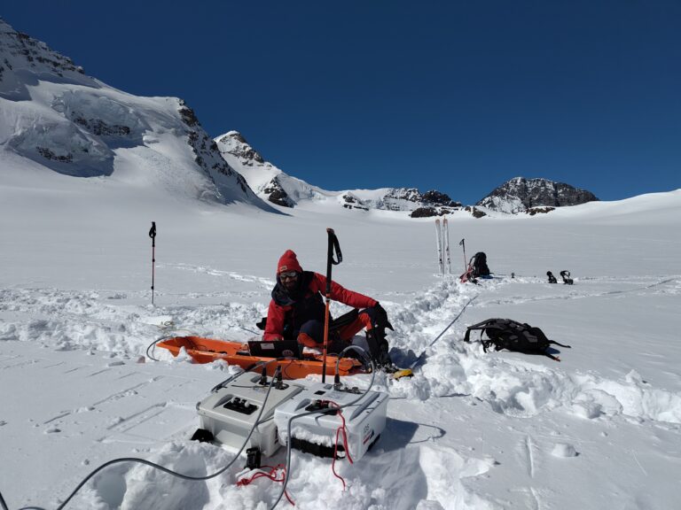
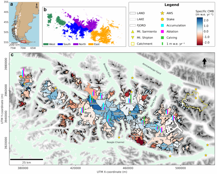
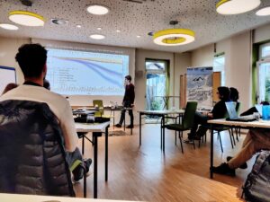
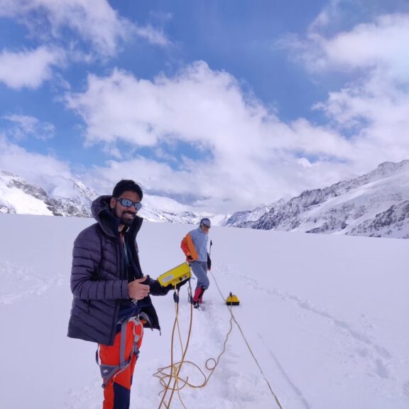
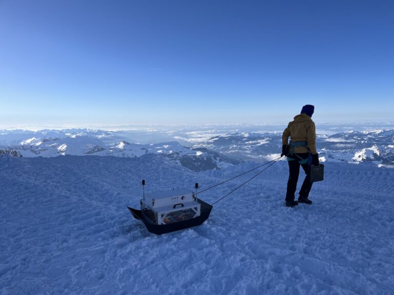
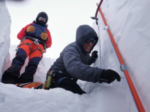
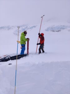
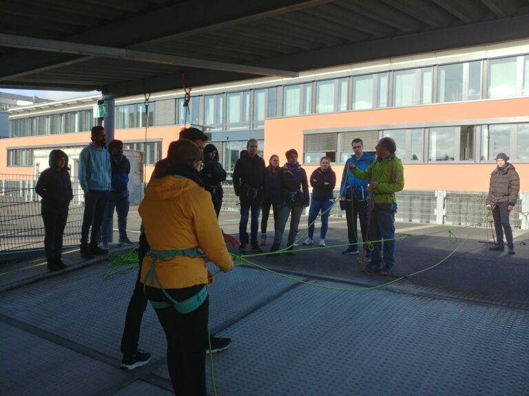
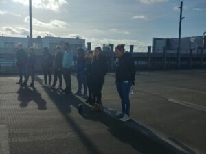
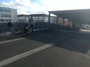
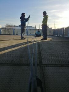
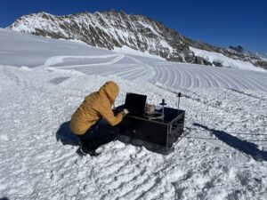
Upon arrival at the hut, we settled in, reviewed our crevasse rescue techniques, and made the final preparations to go onto the glacier. Over the following two days, our goal was to investigate the glacier and its englacial water regime. We used a ground-penetrating radar (GPR) antenna provided by Felix’s working group at TUM. The GPR antenna sends out radar pulses and receives echoes from layers where the density changes. This makes GPR an ideal tool for detecting the bedrock beneath the ice, as well as objects or water within the ice.

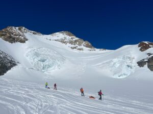
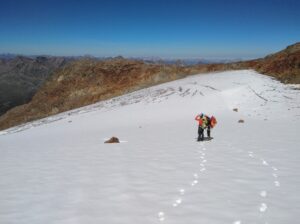
After testing the antenna, we began our measurements on the lower part of the glacier. We skied across the glacier in a zigzag pattern while dragging the antenna behind us to obtain radar profiles perpendicular to the flow direction. We used a 50 MHz center frequency for sufficient penetration depth in the ice and 100 MHz for high resolution of small features.

We were lucky with the weather on the second day and got some sunshine, which made the scenery magnificent. We could complete our measurements and ended up with a dense measurement grid of the lower part of the glacier. After finishing the data acquisition, we were able to relax and enjoy the cozy hut and its view on our third evening.

On Friday, we returned to civilization, bringing with us a new dataset. With the collected data, we now have a record of the englacial water content in spring. Later this year—during the melt season—the measurements will be repeated, and the water content and discharge regime will be compared to the spring data. We are already looking forward to the next fieldwork.

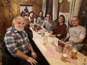
This fieldwork wouldn’t have been possible without the support of Léa and Felix for the data acquisition and the provision of the GPR antennas. Big thanks go to Rainer Prinz for the coordination of the fieldwork and Marie Schroeder and Leo Schlagbauer from UIBK for the accompaniment and hosting in the hut. Those contributions are appreciated.

This project is funded by the Elitenetzwerk Bayern.

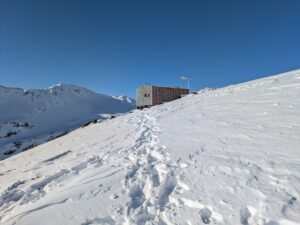
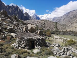
The research station situated on 3026 m a.s.l. above Hintereisferner was established by the UIBK in the 70s.

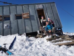
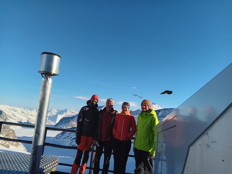
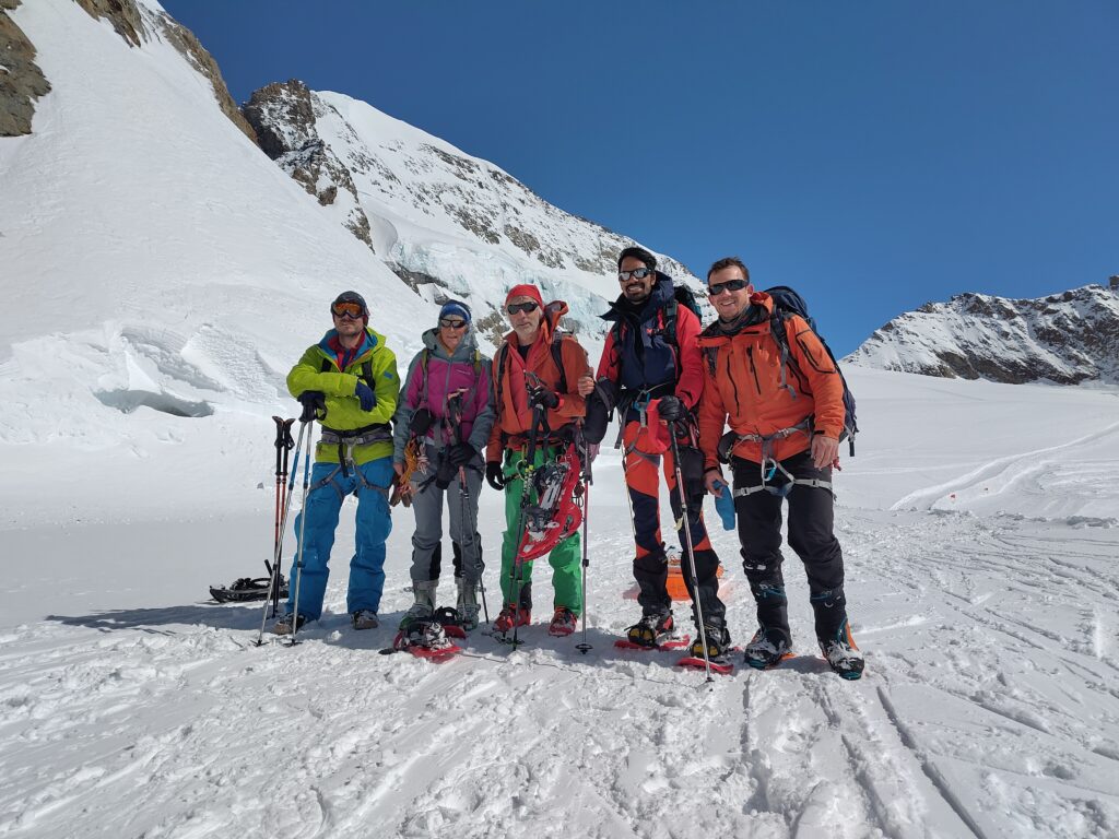
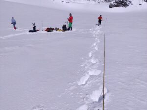
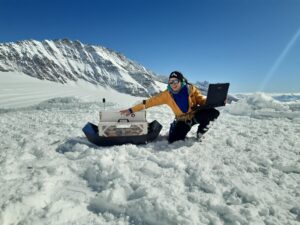
After the successful data acquisition, Felix, Léa and Céline enjoyed the sun outside the hut.

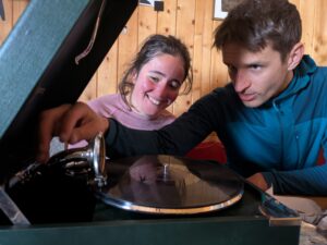
The reseach station was equipped with a portable gramophone and a variety of old vinyls worth listening into.

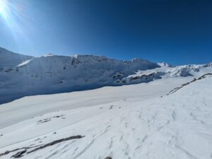
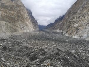
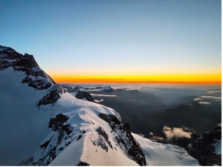
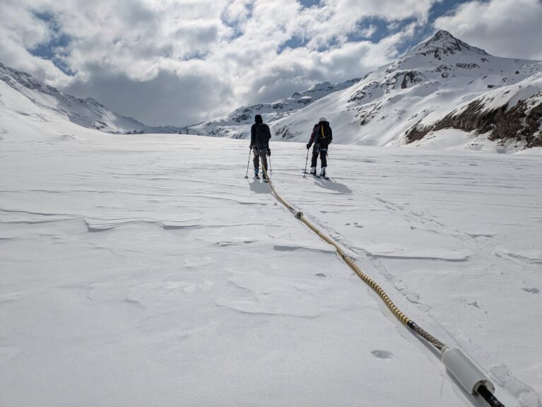
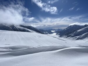
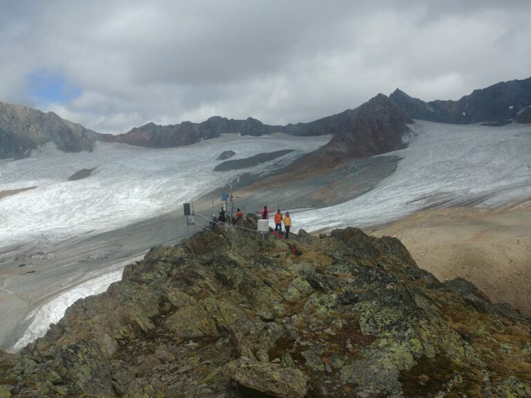
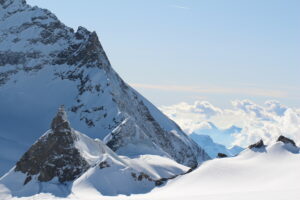
The view on the glacier from the research station.

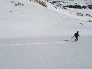
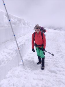
Felix is carrying the GPR antenna over the glacier.

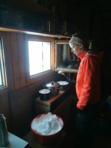
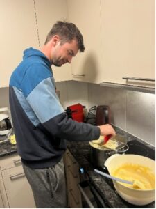
Snow was constantly cooked on the stove in the hut to get drinking water.

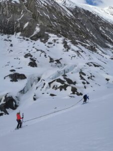
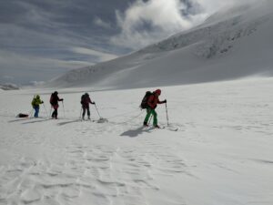
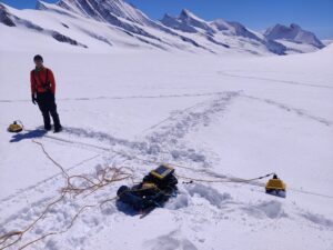
Léa and Céline are dragging the antenna over the uneven glacier tongue.

Publications

Glaciers are melting rapidly – new ESA study demonstrates dramatic developments

The glaciers in the world’s high mountain regions are important freshwater reservoirs, providing resources for drinking water, irrigation and hydropower. However, as a result of climate change, they are melting dramatically and causing sea levels to rise. This has been confirmed by a new international study, in which three researchers from the Institute of Geography were involved and which has now been published in the scientific journal Nature.

The study shows that glaciers have lost an average of 273 billion tons of ice per year since 2000, with an alarming increase in the last ten years. Over the entire period, more than 6,500 billion tons of glacier ice have been lost. This corresponds to a global sea level rise of 18 millimeters in the last two decades. However, there are clear regional differences in the change in glaciated areas: the loss of ice mass in the European Alps compared to the year 2000 is around 39%, while glaciers on the Antarctic islands have only lost 2% of their original mass. Overall, however, the worldwide melting of glaciated areas is now the second largest cause of global sea level rise, surpassed only by the warming of the oceans.

For the “Glacier Mass Balance Intercomparison Exercise” (GlaMBIE) by the European Space Agency ESA, 35 teams consisting of around 450 scientists from all over the world combined observations from field measurements and various satellite missions to create time series of global ice mass changes from 2000 to 2023. As the investigations were carried out using different measurement methods, the new GlaMBIE study not only provides a more detailed description of global and regional glacier development over the last two decades, but also enables a direct comparison of different research approaches. Prof. Dr. Matthias Braun, Dr. Thorsten Seehaus and Dr. Christian Sommer from the Institute of Geography contributed data and analyses on glacier elevation changes based on measurements from the German TanDEM-X satellite mission in the Andes, the European Alps and the Arctic.

Their research was funded by the German Research Foundation (DFG) and the German Aerospace Center (DLR). Prof. Braun coordinates the IDP M³OCCA. Dr. Seehaus leads a DFG Emmy-Noether funded research group that aims to better assess glacier changes and their impacts in the tropical Andes.

https://doi.org/10.1038/s41586-024-08545-z


Event Outreach

Our doctoral candidates present their research in short videos

Our doctoral candidates participated in an activity to make their research better accessible to the broad public. Many of them therefore created short videos where they briefly present themselves and their work. Check it out here:

(the webcam video shown in Manuels video is taken from www.foto-webcam.eu)

Publications

New Publication out now revealing how interactions of glacier, permafrost, and hydrogeology trigger massive rock slope failures situated in the cryosphere

Do you wonder what mechanism caused the massive rock avalanche at Piz Scerscen (Bernina, CH) in spring 2024 (link to DAV-report)? Read the paper: >here<.

Felix Pfluger (TUM, funded by M³OCCA) and colleagues investigated glacier changes, conducted fieldwork on permafrost at 3200 m asl, rock mechanical laboratory studies (Joseph Steinhauser as part of his Bachelor Thesis) and mechanical modeling on a slope scale to infer permafrost–glacier interactions and their implications for triggering high-volume rock slope failures. Using the Bliggspitze rock slide as a case study (Austria, Tyrol), we demonstrate a new type of rock slope failure mechanism triggered by the uplift of the cold–warm dividing line in polythermal alpine glaciers, a widespread and currently under-explored phenomenon in alpine environments worldwide. The publication features a holistic discussion on the role of meltwater and water infiltration/migration in bedrock enabling the buildup of hydrostatic pressure that eventually triggered the rock slide.

With this research, we advance our understanding of coupled processes in complex slope failures situated in the cryosphere.

It was realized as a joint collaboration with researchers from TUM, SLF, BOKU, and FAU.

Event

Guest visit and invited talk by Doug Benn (19.11.2024)

This week, Professor Doug Benn from the University of St. Andrews visited our institute and gave a guest lecture as part of the weekly M3OCCA Research Seminar.

The topic of his lecture was “Icy Oscillators: Understanding glacier surges”

Glacier surges are important but often misunderstood glacier accelerations, which have been observed in many parts of the Arctic, High Mountain Asia, and a few other areas of the world. In this talk, Professor Benn will discuss the geographical distribution of surge-type glaciers and its relationships with climate and glacier geometry. He will go on to show how these patterns can be understood using enthalpy balance theory, a new unifying framework for modelling glacier dynamics. The talk will conclude with a discussion of unsolved problems and possible new directions for research.

During his visit, we had lively discussions on our various research topics and on potential future collaboration. A social gathering with some local cuisine in the evening rounded off his visit.

Thank you again for your wonderful lecture!

Event

Annual workshop of the doctoral program in the Altmühltal

This year’s annual workshop of the International Doctoral Program M3OCCA took place at ‘Krone Kinding’ located in the Altmühltal. The doctoral researchers presented the current status of their research projects and gave an outlook on upcoming activities. The M3OCCA-affiliated project ‘Deep-Learning-Informed Glacio-Hydrological Threat’ (DELIGHT), led by Dr. Samual Cook, was officially introduced and the new colleagues presented to all participants. An important point for discussion within the group of doctoral researchers and PIs was the prolongation proposal for the programme. One of the highlights was the guest lecture from Chad Greene (JPL/Caltech, USA) on ‘Remote Sensing of Glaciers and Ice Sheets’. Socializing activities included a hike through the Altmühltal including a stop at the geographical center of Bavaria and a quiz night on the second evening.


Photo copyright: Oskar Herrmann & Akash Patil

Outreach

Geography at “Klimatag” at Paul-Pfinzing-Gymnasium Hersbruck

At the “Klimatag” (Climate Day) at Paul-Pfinzing-Gymnasium Hersbruck, Thorsten Seehaus (M3OCCA PI) and Philipp Malz from the Institute of Geography at FAU presented the latest findings from glacier research and informed the pupils about the effects of climate change on glaciers. An interactive glacier quiz rounded off the event and ensured fun and lively interest among the pupils. With this participation, the Institute of Geography is committed to raising awareness of climate change and getting young people interested in climate protection and geography.

Publications

Design and Verification of a Versatile and Lightweight Radar Platform for High-Resolution Imaging of Glacial Subsurface Structures

Ground penetrating radar (GPR) is an effective tool in cryosphere and climate research, as it can provide detailed, non-invasive insights into ice thickness, internal structures, and subglacial conditions. This technology uncovers critical data on glacier dynamics and climate change impacts, enhancing our understanding of past, present, and future environmental shifts. In this contribution, the design and experimental verification of a lightweight, surface-based GPR platform intended for imaging glacial subsurface structures is presented. Therein, the system requirements for glaciological applications and the design implications for the developed platform and its components are described. In addition, a detailed overview of the utilized radar system, including the 3D-printed horn antennas and the localization concept, is provided. Furthermore, the imaging properties of the developed system are introduced, and the processing chain to retrieve subsurface images from the raw radar data using synthetic aperture radar concepts is presented. The platform was tested during a field campaign in March 2024 on the Jungfraufirn glacier in Switzerland. The data from this field campaign provide detailed imaging results of the glacier subsurface, including its stratification with high resolution and contrast. Moreover, a comparison of our rather broadband ultra-high frequency GPR measurements to the data acquired with a high-performance state-of-the-art low frequency GPR system is provided. Finally, this contribution concludes with current limitations and an outlook on future improvements.

https://ieeexplore.ieee.org/document/10669622

Outreach

M3OCCA presents research at “Meile der Wissenschaft” at the Schlossgartenfest in Erlangen

Our team had the opportunity to represent the M3OCCA doctoral program at the “Meile der Wissenschaft” during the Schlossgartenfest in Erlangen. This unique event, which brings together FAU staff and prominent figures from the region, was a blend of science, culture, alongside dancing and international cuisine until late into the night.
We were one of three scientific booths, where we presented our research on glacier modeling to a broader public. Visitors engaged in insightful conversations about our work, exploring the importance of glaciers and the impacts of climate change. We showcased the instruments and methods we use to monitor glacier changes, and participants enjoyed an interactive 3D visualization dashboard, which demonstrated glacier projections under various climate scenarios.
Our tent provided a cool space for discussions on a record-breaking hot night (thanks to an ice cube machine!), all while being dressed up in style for the occasion. The event offered a wonderful chance to share our work with the public and highlight the crucial role of glaciers in understanding our changing planet.


Photo copyright: Veena Prasad

Publications

A new, high-resolution atmospheric dataset for southern New Zealand, 2005–2020

The regional climate of New Zealand’s South Island is shaped by the interaction of the Southern Hemisphere westerlies with the complex orography of the Southern Alps. Due to its isolated geographical setting in the south-west Pacific, the influence of the surrounding oceans on the atmospheric circulation is strong. Therefore, variations in sea surface temperature (SST) impact various spatial and temporal scales and are statistically detectable down to temperature anomalies and glacier mass changes in the high mountains of the Southern Alps. To enable future studies on the processes that govern the link between large-scale SST and local-scale high-mountain climate, we utilized dynamical downscaling with the Weather Research and Forecasting (WRF) model to produce a regional atmospheric modelling dataset for the South Island of New Zealand over a 16-year period between 2005 and 2020. The 2 km horizontal resolution ensures realistic representation of high-mountain topography and glaciers, as well as explicit simulation of convection. The dataset is extensively evaluated against observations, including weather station and satellite data, on both regional (in the inner domain) and local (on Brewster Glacier in the Southern Alps) scales. Variability in both atmospheric water content and near-surface meteorological conditions is well captured, with minor seasonal and spatial biases. The local high-mountain climate at Brewster Glacier, where land use and topographic model settings have been optimized, yields remarkable accuracy on both monthly and daily time scales. The data provide a valuable resource to researchers from various disciplines studying the local and regional impacts of climate variability on society, economies and ecosystems in New Zealand. The model output from the highest resolution model domain is available for download in daily temporal resolution from a public repository at the German Climate Computation Center (DKRZ) in Hamburg, Germany (Kropač et al., 2023; 16-year WRF simulation for the Southern Alps of New Zealand, World Data Center for Climate (WDCC) at DKRZ [data set], https://doi.org/10.26050/WDCC/NZ-PROXY_16yrWRF).

https://rmets.onlinelibrary.wiley.com/doi/10.1002/gdj3.263

Publications

Out-of-the-box calving-front detection method using deep learning

Glaciers across the globe react to the changing climate. Monitoring the transformation of glaciers is essential for projecting their contribution to global mean sea level rise. The delineation of glacier-calving fronts is an important part of the satellite-based monitoring process. This work presents a calving-front extraction method based on the deep learning framework nnU-Net, which stands for no new U-Net. The framework automates the training of a popular neural network, called U-Net, designed for segmentation tasks. Our presented method marks the calving front in synthetic aperture radar (SAR) images of glaciers. The images are taken by six different sensor systems. A benchmark dataset for calving-front extraction is used for training and evaluation. The dataset contains two labels for each image. One label denotes a classic image segmentation into different zones (glacier, ocean, rock, and no information available). The other label marks the edge between the glacier and the ocean, i.e., the calving front. In this work, the nnU-Net is modified to predict both labels simultaneously. In the field of machine learning, the prediction of multiple labels is referred to as multi-task learning (MTL). The resulting predictions of both labels benefit from simultaneous optimization. For further testing of the capabilities of MTL, two different network architectures are compared, and an additional task, the segmentation of the glacier outline, is added to the training. In the end, we show that fusing the label of the calving front and the zone label is the most efficient way to optimize both tasks with no significant accuracy reduction compared to the MTL neural-network architectures. The automatic detection of the calving front with an nnU-Net trained on fused labels improves from the baseline mean distance error (MDE) of 753±76 to 541±84 m. The scripts for our experiments are published on GitHub (https://github.com/ho11laqe/nnUNet_calvingfront_detection, last access: 20 November 2023). An easy-access version is published on Hugging Face (https://huggingface.co/spaces/ho11laqe/nnUNet_calvingfront_detection, last access: 20 November 2023).

https://tc.copernicus.org/articles/17/4957/2023/

Allgemein Event

Workshop on ‘How to give a good talk’

We organized a one-day workshop on ‘How to give a good talk’.

The workshop covered various topics from Stage fright over Body Language to Humor in talks. The participants benefited a lot from the intensive feedback they received from their colleagues and the trainer.

Thank you again, Nae, for the great workshop!

Publications

A Drifting and Blowing Snow Scheme in the Weather Research and Forecasting Model

Transport of snow by the wind can have high impact on local glacier mass changes as it leads to non-uniform amounts of snow on the ground. In order to simulate and better understand this process we introduce a new modeling framework that is included into the widely used atmospheric ‘Weather Research and Forecasting (WRF)’ model. Test simulations and sensitivity experiments show the physical consistency of the model. Complex interactions between different processes like snow erosion, drifting snow sublimation and the wind field show the necessity of coupling the snow and atmospheric models.

https://agupubs.onlinelibrary.wiley.com/doi/full/10.1029/2023MS004007

Event

Fieldwork at Aletsch Glacier Part 2 (May 2024)

As a continuation of the expedition to the Aletsch Glacier in winter 2024, a group of researchers conducted a second expedition in May as part of the M3OCCA program. The group aimed to gather GPR CMP data at three different locations of the accumulation area of the Aletsch Glacier. Snow pits were dug near CMP locations to obtain a density-depth profile at the upper few meters of snow to get the density profile between the visits in March and May 2024. The GPR CMP method provides vital information regarding the Electromagnetic (EM) wave velocity-depth within the firn body of the glacier. The density of the firn body is a function of the EM wave velocity; the obtained density-depth profile aids in the detection and estimation of annual firn layers to study the firn densification rate. This information assists in estimating the mean glacier mass balance by considering the firn density rather than assuming a constant density value for the entire glacier.

This expedition was part of the M3OCCA doctoral program project 2.3 (Improved Glacier volume to mass conversion), and the efforts of Dr. Christoph Mayer and Dr. Astrid Lambrecht from BAdW Munich, Akash Patil (M3OCCA PhD at BAdW Munich), and Manuel Saigger (M3OCCA PhD at the Institute of Geography FAU Erlangen) are much appreciated.

Event

Fieldwork at Aletsch Glacier February/March 2024

At the end of February, a large field campaign with various measurement instruments from different research groups took place at the Aletsch Glacier. The group consisted of scientists and technicians from FAU Erlangen, different DLR institutes (HR, OS, DFD), Technical University Munich, Bavarian Academy of Sciences, the institute for snow and avalanche research (SLF), Ulm University and ETH Zürich. The campaign involved in-situ density and permittivity measurements, surface- and UAV-based ground penetrating radar (GPR) measurements, airborne acquisitions for tomography and SAR applications, bistatic radar measurements with the KAPRI system, and first tests with an optical localization system. The observed test sites were distributed over the glacier, reaching from the Jungfraufirn to the Mönchsjochplateau and further to the Ewigschneefeld. The surface-based GPR platform (top picture) developed in subproject 1.1 by our PhD student Lena Krabbe was tested in rough environmental conditions for the application of subsurface imaging of glacier stratification.

Within subproject 2.3, GPR was used to collect data illustrating the spatial distribution of the firn body. GPR transects across different parts of the accumulation area of the Aletsch Glacier were obtained by our PhD student Akash Patil, along with direct measurements using glaciological methods like snow pits and firn cores at some locations near the GPR transects. Isotope samples were also taken from the snow pit and firn cores to determine possible annual layers and their corresponding depths. This helps in understanding the regional variability of density distribution and glacier-climate interaction on a regional scale to determine and validate density assumptions that aid in estimating the mean glacier mass balance.

Many thanks to Dr. Thorsten Seehaus and Dr. Alexander Gross from the Institute of Geography FAU Erlangen, Michael Stelzig from LHFT, FAU Erlangen, and M3OCCA PhDs Patricia Schlenk (DLR, Munich) and Felix Pfluger (TUM, Munich) for their assistance during this expedition.


Publications

Supraglacial Lake Evolution over Northeast Greenland Using Deep Learning Methods

Supraglacial lakes in Greenland are highly dynamic hydrological features in which glacial meltwater cumulates, allowing for the loss and transport of freshwater from a glacial surface to the ocean or a nearby waterbody. Standard supraglacial lake monitoring techniques, specifically image segmentation, rely heavily on a series of region-dependent thresholds, limiting the adaptability of the algorithm to different illumination and surface variations, while being susceptible to the inclusion of false positives such as shadows. In this study, a supraglacial lake segmentation algorithm is developed for Sentinel-2 images based on a deep learning architecture (U-Net) to evaluate the suitability of artificial intelligence techniques in this domain. Additionally, a deep learning-based cloud segmentation tool developed specifically for polar regions is implemented in the processing chain to remove cloudy imagery from the analysis. Using this technique, a time series of supraglacial lake development is created for the 2016 to 2022 melt seasons over Nioghalvfjerdsbræ (79°N Glacier) and Zachariæ Isstrøm in Northeast Greenland, an area that covers 26,302 km2 and represents roughly 10% of the Northeast Greenland Ice Stream. The total lake area was found to have a strong interannual variability, with the largest peak lake area of 380 km2 in 2019 and the smallest peak lake area of 67 km2 in 2018. These results were then compared against an algorithm based on a thresholding technique to evaluate the agreement of the methodologies. The deep learning-based time series shows a similar trend to that produced by a previously published thresholding technique, while being smoother and more encompassing of meltwater in higher-melt periods. Additionally, while not completely eliminating them, the deep learning model significantly reduces the inclusion of shadows as false positives. Overall, the use of deep learning on multispectral images for the purpose of supraglacial lake segmentation proves to be advantageous.

https://www.mdpi.com/2072-4292/15/17/4360

Outreach

Invited talk with the Federal Minister of Education and Research Bettina Stark-Watzinger at the Digital Summit 2023 by Nora Gourmelon

Explaining my research to the Federal Minister of Education and Research Bettina Stark-Watzinger at the Digital Summit 2023 was a great privilege! The Minister impressed me with her eagerness to understand the connections and implications of my research. My research area is green AI, where I am currently focusing on AI-based automation of glacier monitoring.With this automation, it will soon be possible to study the dynamics of glacier calving fronts in the Arctic over the years and during different seasons. This knowledge will help us to better understand the effects of climate change on glaciers. In addition, we will be able to calibrate our glacier and climate models with the extracted front positions and thus further improve them.

by Nora Gourmelon

Copyright photos: AI Grid/Franziska Peters

Event

Basic Glacier Safety Workshop

The next fieldwork season is coming! Several M3OCCA members will already join a large field campaign at Aletsch-Glacier in February/March 2024. Thus, a self-organized workshop on basic glacier safety was carried out in Erlangen. After repeating some theoretical background, the focus was set on hands-on exercises. Everyone got the chance to get first knowledge or to re-fresh the knowledge in topics like crevasse rescue, self-rescue, repelling…

Special Thanks to Manuel Saigger, who led the workshop.

Publications

Estimating ice discharge of the Antarctic Peninsula using different ice-thickness datasets

The Antarctic Peninsula Ice Sheet (APIS) has become a significant contributor to rising sea levels, and accurately estimating ice discharge from its outlet glaciers is essential for assessing the mass balance of the region. This study calculates ice discharge from APIS outlet glaciers north of 70°S using five commonly used ice-thickness reconstructions, employing a consistent surface velocity field and flux gates. Results indicate a total volumetric ice discharge ranging from 45 to 141 km3 per year for 2015–2017, with a mean of 87 ± 44 km3 per year. The substantial differences in results highlight the large uncertainty in current ice-discharge estimates, emphasizing the challenge of accurately modeling the ice-thickness distribution in this complex and data-scarce region.

https://www.cambridge.org/core/journals/annals-of-glaciology/article/estimating-ice-discharge-of-the-antarctic-peninsula-using-different-icethickness-datasets/67B2F8FC77CD9342BD07DAACA41497AF

Publications

TanDEM-X reveals ice surface elevation change patterns throughout the Antarctic Peninsula

Existing mass budget estimates for the northern Antarctic Peninsula (>70° S) are affected by considerable limitations. We carried out the first region-wide analysis of geodetic mass balances throughout this region (coverage of 96.4 %) for the period 2013–2017 based on repeat pass bi-static TanDEM-X acquisitions. A total mass budget of −24.1±2.8 Gt/a is revealed. Imbalanced high ice discharge, particularly at former ice shelf tributaries, is the main driver of overall ice loss.

https://tc.copernicus.org/articles/17/4629/2023/tc-17-4629-2023.html


Allgemein Event

Joint field work of MOCCA members Manuel and Felix to install rock temperature loggers at the study site in Kaunertal

Knowledge about permafrost distribution is critical for the assessment of rock mass stability. By installing rock surface temperature loggers we aim to create a model to explore the distribution of permafrost in the Ötztal Alps. Solar incoming radiation and air temperature are the main drivers of permafrost evolution. Therefore we picked diverse locations in height, aspect and slope for installing the loggers.

The field work took place on a wonderful sunny day on 6th of September 2023. We are happy that everything worked out as planned and we returned home from the mountains in a safe way with good new stories on our shoulders.

Event

Annual workshop of the doctoral programme M3OCCA in Obergurgl

The annual workshop of the International Doctoral College M3OCCA took place this year in September at the University Centre in Obergurgel. The doctoral students presented the current status of their research projects and gave an outlook on upcoming activities. In addition to the report colloquium and organisational discussions, there were topic-specific guest lectures by Prof. Dr. Francisco Navarro (UPM, Madrid), Prof. Dr. Helmut Rott (Uni. Innsbruck & ENVEO), and Dr. Wolfgang Gurgiser (Uni. Innsbruck). The workshop was followed by a two-day excursion to the Vernagtferner. Dr Christoph Mayer from the Bavarian Academy of Science explained to the participants the diverse glacier monitoring programme, which has been carried out for more than 50 years.

Event

M3OCCA PhD candidates visited DLR in Oberpfaffenhofen

Members of the M3OCCA project visited the facilities of DLR in Oberpfaffenhofen on the 5th. July 2023.

During the visit, the project partners and M3OCCA members gave an overview of the activities at DLR including a guided tour of the Techlab.

Impressive was in particular the visit of the German Space Operations Centre (GSOC), where different space missions and the Columbus Module of the International Space Station are monitored and controlled.

Allgemein Publications

Caffe – A Benchmark Dataset for Glacier Calving Front Extraction from Synthetic Aperture Radar Imagery

The study emphasizes the importance of understanding marine-terminating glacier dynamics in glacier projections. Deep learning methods can automate the extraction of calving front positions from satellite imagery, reducing manual effort. The “CaFFe” dataset, which includes annotated calving fronts in Synthetic Aperture Radar (SAR) imagery, offers a standardized benchmark for evaluating deep learning techniques in this area. Researchers can use CaFFe to assess the performance of upcoming deep learning models and identify promising research directions. A leaderboard of models can be found at https://paperswithcode.com/sota/calving-front-delineation-in-synthetic.

https://ieeexplore.ieee.org/abstract/document/10283406

Publications

Conditional Random Fields for Improving Deep Learning-Based Glacier Calving Front Delineations

Advancements in Deep Learning have enabled the automated identification of glacier calving fronts in satellite imagery. This study improves the accuracy of this process by incorporating a Conditional Random Field (CRF) into the post-processing of the neural network’s predictions. Experiments using the CaFFe dataset showed a 27-meter improvement in mean distance error. The code is available at https://github.com/EntChanelt/GlacierCRF.

https://ieeexplore.ieee.org/document/10282915

Event

Invited talk by Susanne Støle-Hentschel 31.07.2023

Title: How can we understand the dynamics of ocean waves from measurements and simulations?

The presentation introduces some of the core techniques used for measuring ocean waves and outlines why it is difficult to interpret those measurements.
The main focus of the talk will be dedicated to explaining the imaging mechanism of X-band radars. The talk will include a brief overview to freak waves in sea states where multiple wave systems meet.

Susanne is a PostDoc in the ERC project HIGHWAVE at Ecole Normale Supérieure (ENS) Paris-Saclay. She has achieved her Master’s and PhD at the University of Oslo, Norway. With a background in applied maths and fluid mechanics, Susanne has worked with a number of different applications, ranging from biomedical flows to ocean waves. In recent years she has pursued the study of ocean waves by combining numerical simulations and measurements. One of her focus areas is the interpretation of radar measurements of the ocean surface. Extracting wave information from radar images requires combining signal processing and an understanding of the imaging mechanism.

Event

M³OCCA PhD students participate in field campaign on the Jungfraufirn in Switzerland

In March 2023 two of our M³OCCA PhD students, Lena Krabbe from LHFT/ FAU Erlangen and Akash Patil from BAdW Munich, joined a three-week field test campaign taking place at the Jungfraufirn on the Aletsch glacier in Switzerland. Therein, they were able to collect multiple data sets from different Ground Penetrating Radar (GPR) systems, namely a commercial GPR system as well as a GPR sled developed by Lena Krabbe at LHFT.  Field campaigns like this are an essential part of glacier and ice research in order to assess the system performance in the field as well as to check, whether the systems and solutions developed in the lab are also capable of enduring extreme environmental conditions that are present on glaciers. Moreover, the collected data is a great basis for a performance comparison not only between the two surface-based GPR systems, but also for comparing them to further measurement equipment tested during this field campaign. The latter includes a melting probe consisting of a radar, a sonar and a permittivity sensor as well as UAV-based radar and lidar systems. During the field test, two main measurement sites were evaluated, including an area close to the Mönchsjoch as well as the camp site below the Sphinx, which is also close to the glacier entrance. Furthermore, also more remote places where evaluated after being explored and assessed together with a mountain guide. Overall, this field test was a great opportunity to gain experience in applied glacier research and intensify the collaboration inside the M³OCCA doctoral program.


Outreach

AI Newcomer Award 2023 goes to Nora Gourmelon from FAU’s Pattern Recognition Lab

Nora Gourmelon (Photo: second from right) is honored with the AI Newcomer Award 2023 in the field of natural and life sciences for her research in Green AI, a research field that tackles sustainability-related problems with AI.

In her current work, conducted as part of the International Doctoral Program (IDP) “Measuring and Modeling Mountain glaciers and ice caps in a Changing ClimAte (M³OCCA),” she is developing deep-learning techniques for extracting glacier front positions from satellite imagery.

When asked what the award means to her, Gourmelon responds: “The award helps to raise awareness of how you can also get involved in biodiversity and climate protection as a computer scientist. In addition, I am, of course, also very pleased about the great recognition for my research to date.”

The AI Newcomer Award is granted by the German Association of Computer Science (Gesellschaft für Informatik) to young researchers under 30 years for innovative developments in the area of artificial intelligence.

The award ceremony took place in Berlin on April 26 as part of “KI-Camp 2023,” an event for young AI researchers organized by the German Association of Computer Science and the German Federal Ministry for Education and Research (Bundesministerium für Bildung und Forschung).

The recording of the ceremony will be published here soon.

The award has also attracted the attention of the media and the press!

Event

Invited talk on „Keeping track of change – Monitoring Antarctic calving front dynamics with earth observation and deep learning“

The Institute of Geography at FAU Erlangen-Nürnberg will host an invited talk by Dr. Celia Baumhoer (DLR/DFG Oberpfaffenhofen).

When: Wednesday, 14.06.2023, 12:30-14:00

Where: Seminar room, Wetterkreuz 15, 91058 Erlangen

Abstract:

The Antarctic coastline is constantly changing. Three-quarters of the coastline are fringed by ice shelves, the floating extensions of the Antarctic ice sheet. The retreat or disintegration of ice shelves with buttressing forces cause enhanced mass loss of the Antarctic ice sheet increasing global sea level rise.  Continuously tracking ice shelves is challenging because manual mapping cannot keep up with growing satellite archives and automated approaches fail due to the complexity of the Antarctic coastline. Recent advances in deep learning and easy access to high performance computing facilitated a fully-automated framework able to regularly monitor Antarctic ice shelf front dynamics. This presentation explores the unprecedented dense time series of calving front change providing new insights into ice shelf front dynamics and establishes links to ice dynamical and environmental controls on ice shelf extents.

Event

Invited talk on “Deep-learning-driven estimation of global glacier thickness”

The Institute of Geography at FAU Erlangen-Nürnberg will host an invited talk by Dr. Samuel Cook (Univ. Lausanne).

When: Wednesday, 17.05.2023, 12:30-14:00

Where: Seminar room, Wetterkreuz 15, 91058 Erlangen

Abstract:

I present my ongoing work using the emulator from the Instructed Glacier Model (IGM) (https://github.com/jouvetg/igm) to invert for ice thickness at the 200,000 glaciers in the world outside the polar ice sheets. The basis of the emulator is a convolutional neural network trained on the outputs of full-Stokes simulations of real glaciers. Provided with surface velocities – taken from the new global dataset compiled by Millan et al. (2022) – and surface DEMs, this emulator can invert for thickness at any glacier in the world with a comparable accuracy to traditional full-Stokes inversion, but at a fraction of the computational cost. This allows us to greatly improve our estimates of global glacier volume, vital both for prediction of sea-level rise, but also for local communities in mountainous areas, who often rely on glacier melt for a large proportion of their water resources. I will discuss the rationale and methods behind my work, as well as preliminary results and the problems I’m currently working on.

Publications

Automated Detection of Glacier Surges from Sentinel-1 Surface Velocity Time Series—An Example from Svalbard

Research on surge-type glaciers, although they constitute a small percentage of all glaciers, significantly contributes to understanding glacier flow mechanisms. Recent studies have utilized remote sensing techniques to unravel these processes, highlighting the potential of combining high-performance computing and earth observation. While modeling surge events has gained popularity, there is a lack of comprehensive spatial and temporal data on surge timing. To address this, an algorithm has been developed that not only detects surge-type glaciers but also determines the onset of surges. The algorithm relies on time series analysis of glacier surface velocity using Sentinel-1 data, involving seasonal and trend decomposition and outlier detection via the General Studentized Extreme Deviate Test. Cluster analysis is then applied to identify outlier clusters associated with glacier surges. The method’s effectiveness was demonstrated in the Svalbard archipelago between 2015 and 2021, where 18 glacier surges and their timing were successfully identified.

https://www.mdpi.com/2072-4292/15/6/1545

Allgemein Publications

AMD-HookNet for Glacier Front Segmentation

This article discusses the importance of tracking changes in glacier calving front positions as a means of assessing glacier status. Remote sensing imagery is a valuable tool for this purpose, but manual monitoring for all global calving glaciers is impractical due to time constraints. The article introduces a novel framework called AMD-HookNet, designed for the segmentation of glacier calving fronts in synthetic aperture radar (SAR) images. AMD-HookNet enhances feature representation by leveraging an attention mechanism and interactions between low-resolution and high-resolution inputs. The experiments conducted on a benchmark dataset demonstrate that AMD-HookNet outperforms the current state of the art by achieving a mean distance error of 438 meters to the ground truth, confirming its effectiveness.

https://ieeexplore.ieee.org/document/10044700?source=authoralert

Publications

A Tutorial on the Sequential Sampling Impulse Radar Concept and Selected Applications

The concept of the sequential sampling is well known and still widely used in industrial automation radar applications due to its hardware simplicity, low cost and low power consumption. However, there is only a limited amount of publications that describe this concept and its variants in detail. This tutorial introduces the typical sequential sampling impulse radar concept step by step and presents several key characteristics, such as correlation properties and SNR considerations. In addition to the system theory, selected applications are presented to illustrate the attractiveness and elegance, but also the limits of this radar concept. The shown applications range from those in industrial automation to radar concepts in the areas of automotive radar, security scanners, biomedical radar systems and ground penetrating radar. The latter application is among others including the analysis of glaciers, e.g. to determine the ice thickness and stratification in order to provide a better understanding of the glacier and its behavior in a changing climate.

The corresponding paper can be found here:

A Tutorial on the Sequential Sampling Impulse Radar Concept and Selected Applications

Event

Annual Retreat at Josefstal in November 2022

The first annual Retreat within the IDP M3OCCA took place at “Studienzentrum Josefstal” in early November 2022.

During the workshop, all Ph.D. students provided an overview of their individual PhD projects with subsequent discussions.

Additionally, further steps within the IDP M3OOCA program were discussed and defined.