SP2

SP2 SPs

SP2.1: Glacier outlines from optical and SAR imagery by deep learning

Subproject 2.1

Glacier outlines from optical and SAR imagery by deep learning

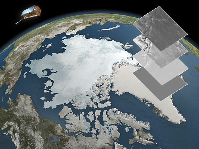
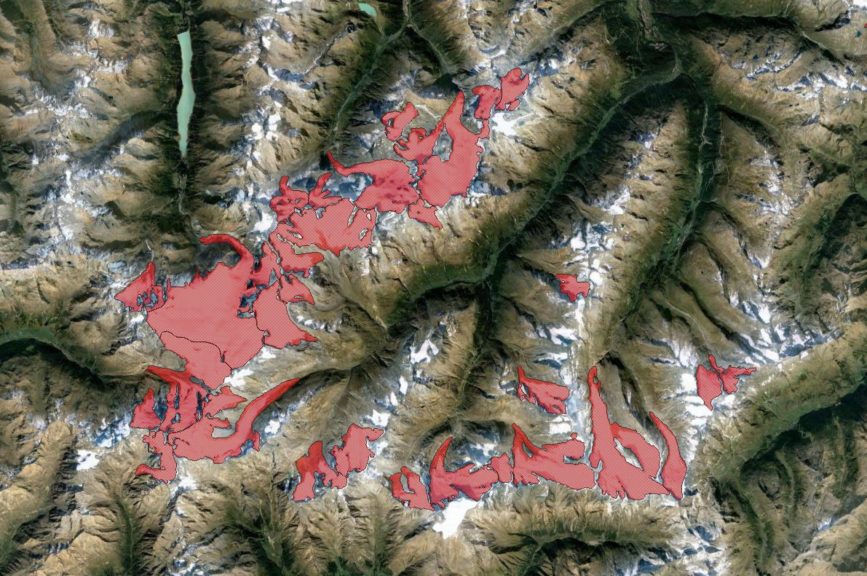
Glacier extent is an ECV and various international attempts exist to harmonize a global glacier inventory data set with outlines if possible from multiple data sources (GLIMS, IASC Randolph Glacier Inventory, RGI).
However, to date no real operational large-scale repeat mapping capabilities exist. Glacier outlines are required at different time intervals e.g. with matching observational intervals for specific mass balance computations out of remote sensing measurements (e.g. for comparison with in-situ observations or on regional scale) or to validate ice dynamic modelling. In particular for small fast changing glaciers area updates are important since errors from area mismatch are highest.

While for calving glaciers various deep learning approaches exist outlines of land-terminating glaciers are often more difficult to delineate, in particular when the glacier tongue is debris-covered. We aim at an approach that integrates the advantages of synthetic aperture radar and optical observation capabilities and analysis techniques. The candidate is supposed to advance our existing processing setup and to develop and systematically test a new method. Within this doctoral project we aim at training a machine learning algorithm using multi-temporal SAR coherence images jointly with other data. This SP has strong thematic links to SP3.2 and 3.3 and methodological to SP 2.2.

For specific information on the sub-project please contact: Prof. Dr. Matthias Braun, Institut für Geographie, FAU, Wetterkreuz 15, 91058 Erlangen, T: +49 9131-85-22015, matthias.h.braun@fau.de, https://www.geographie.nat.fau.de/

Co-PIs: E. Bänsch (FAU Mathematics), P. Rizzoli (DLR HR), M. Zemp (Univ. ZH)


Get to know our project affiliated PhD students
Katrina Bartek

katrina.bartek@fau.de

Originally coming from Michigan in the United States, I received my bachelor’s degree in Mechanical Engineering from the University of Michigan in April 2017. After subsequently working in the aviation field for a year, I moved to Munich to pursue my master’s degree in Earth Oriented Space Science and Technology at the Technical University of Munich. This program explored the uses of remote sensing, the technology behind it, and the geophysical processes to be observed. Through this, my desire to pursue research in the cryosphere was inspired and I started research in the Institute of Geography at the Friedrich-Alexander-Universität Erlangen-Nürnberg in May 2021.

This research focused on using deep learning techniques to detect supraglacial lakes in Northeast Greenland using Sentinel-2 data. Having been accepted to the IDP M3OCCA program, I am excited to now pursue my doctoral degree with the focus on the improvement of glacier outline segmentation using various remote sensing data while using the strengths of artificial intelligence.

SP2 SPs

SP2.2: Radar penetration of TanDEM-X on glaciers & ice caps SAR tomography for 3D imaging of snow and firn structures

Subproject 2.2

Radar penetration of TanDEM-X on glaciers & ice caps SAR tomography for 3D imaging of snow and firn structures

The radar signal can penetrate into snow, firn, and ice bodies depending on liquid water content and internal structure of the porous medium as well as radar imaging parameters. Consequently, the interferometric phase center of the backscattered radar signal is located at a certain depth below the actual topographic surface, leading to a bias between the glacier surface and the estimated one from SAR interferometry (Rott et al 2021, Rizzoli et al 2017). Radar penetration is still a large source of uncertainty in estimates of glacier volume and mass change from bi-static SAR mission data like bi-static TanDEM-X or the upcoming HRWS MirrorSAR (Braun et al. 2019, Huber et al. 2020).

The uncertainty is highest in presence of dry snow, not affected by melting phenomena as in the accumulation area of high mountain glaciers or polar glaciers and ice caps outside the large ice sheets. Within this sub-project, we aim at estimating radar penetration by deploying a deep learning architecture using input data from SAR imagery like coherence, backscatter, frequency and geometric baseline as well as a terrain model. As reference data for training deep learning networks in a supervised manner, we will utilize the height difference between precise laser altimetric measurements (ICESat-2, Operation IceBridge, ka-band data from JPL UAVSAR system) for the surface and radar DEMs for the location of the mean interferometric phase center.

Methodologically, we suggest the use of a deep convolutional network to estimate the altimetry, phrasing it as a regression problem. In particular, we propose the adoption of AdaIn-based Tunable CycleGAN (Gu 2020). We believe the additional CycleGAN constraints in combination with the switchable adaptive instance normalization will serve as a valuable regularizer. Making the CycleGAN tunable and hence, omitting one generator from the original CycleGAN approach, leads to a significant reduction in memory requirements and a more stable training process even on small datasets. Additionally, we can incorporate other data such as the local incident angle as well as climatological information as conditional input for the discriminators, since both variables can significantly influence the interferometric SAR phase center depth below the actual surface. This SP is linked to SP 1.2 with a joint airborne survey as well as to SP 2.3 and SP 3.1.

For specific information on the sub-project please contact: Dr.-Ing. Paola Rizzoli, Münchener Straße 20, 82234 Weßling, T: 08153-28-1785, Paola.Rizzoli@dlr.de, https://www.dlr.de/hr/desktopdefault.aspx/tabid-2328/3447_read-46107

Co-PIs: M. Braun (FAU Geography), A. Maier (FAU Informatics), P. Millilo (Univ. Houston)


Get to know our project affiliated PhD students


Alexandre Becker

alexandre.campos@dlr.de

I am a Ph.D. student both at the German Aerospace Center (DLR) and the Friedrich-Alexander-Universität Erlangen-Nürnberg (FAU), being supervised by Prof. Matthias Braun (FAU) and Dr. Paola Rizzoli (DLR).

I have a bachelor’s in Electrical Engineering and a master’s in Telecommunications, both from universities in Brazil (where I came from!). The goal of my research was to develop methods for target detection and pattern recognition in synthetic aperture radar (SAR) images, mainly in military applications. After I received my master’s degree (March/2021) and seeking to work in a field in which I could see my work impacting people’s lives, I worked as a data scientist for a startup in Brazil, tackling problems in the agribusiness market. The company was heavily driven by how to improve the sustainability of medium- and large-sized companies and farmers in agriculture, which was a great learning experience and provided a lot of personal growth.

In this scenario, I heard about the IDP M³OCCA project and its ambition to be an interdisciplinary and international environment aiming at understanding and solving problems that can truly impact society. I am glad to be part of the project and thrilled to continue my research career in such a place.


SP2 SPs

SP2.3: Improved volume to mass conversion

Subproject 2.3

Improved volume-to-mass conversion

Glacier mass balance variations are an essential indicator of regional and global climate fluctuations. Today, glacier volume changes can be detected with satellite based systems to a reasonable degree of accuracy, while density estimates of the affected volume are still based on models and a priori assumptions. Even though, methods for volume to mass conversion are established, there exists a considerable knowledge gap with respect to the validation and temporal stability of the assumptions. Especially the transient evolution of the firn pack will strongly influence the density assumptions of the glaciers with time. During periods of negative mass balances, the shrinkage of the snow and firn resources requires an adaptation of the usual conversion techniques. In addition, there is a strong need to investigate the regional variability of density distribution, as the glacier-climate relation is strongly dependent on the regional characteristics like topography, precipitation and wind patterns.

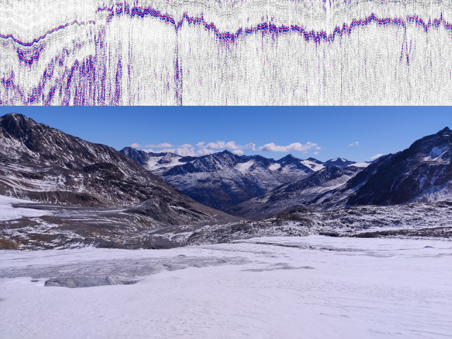
A large data basis exists for Vernagtferner in the Ötztal, related to the temporal development of the glacier and its firn regions. Similar information is available for the adjacent Hintereisferner, making this region an ideal test site for such investigations. A detailed investigation of firn and snow deposits, based on glaciological and geophysical methods and microwave remote sensing instruments should be conducted to provide a clear knowledge about the firn pack architecture and its spatial distribution. In combination with legacy remote sensing observations of firn and snow extents and volume changes, regional climate information will be used to investigate the temporal development of glaciers and their compartments. This analysis should lead to a strongly improved approach for volume to mass conversion, especially with regard to temporal and regional variability, which is also essential for large-scale mass balance assessments. Direct employment of the results in, and exchange with the modelling-orientated sub-projects will be possible and highly welcome.

For specific information on the sub-project please contact: Dr. Christoph Mayer, Alfons-Goppel-Str. 11 (Residenz), 80533 München, T: 089-23031-1260, Christoph.Mayer@badw.de, https://geo.badw.de/das-projekt.html

Co-PIs: T. Mölg (FAU Geography), M Huss (ETH ZH), R. Hock (Univ. Oslo)


Get to know our project affiliated PhD students


Akash Patil

Room 320,

Geodesy and Glaciology,

Bavarian Academy of Science and Humanities,

Email: akash.patil@badw.de

Phone: +49-(0) 89230311201

I am a PhD student working at BAdW Munich in collaboration with FAU Erlangen. My working research project is mainly on the density profiling of the snow to ice on the Alpine glaciers.  My fascination with researching glaciers has come from my time during my master’s in Applied & Environmental Geoscience (AEG) at the University of Tuebingen Germany. Where I have attained enough knowledge on the application of GPR to subsurface hydrogeology as my Master’s thesis under the supervision of Prof. Dr Reinhard Drews. My push towards nature science can be attributed to my bachelor’s studies in Civil engineering and my working experience in the construction industry and with the NGO as an Environmental and Civil engineer.

In my PhD, research is on the quantitative study of the variation of density with the depth from Snow to Ice in the Alpine Glaciers mainly on the Vernagtferner glacier. Application of GPR to attain spatial and temporal data at the accumulation zone during different seasons of the year, to track the boundary between firn and ice and to understand the dynamics of the glaciers with the regional climate change. This work is supervised by Dr Christoph Mayer at BAdW Munich and Prof. Dr Thomas Mölg from FAU Erlangen.